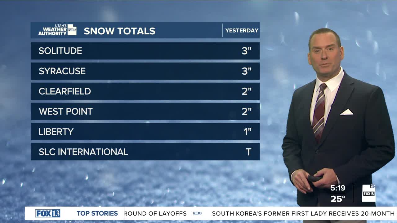


Yesterday's storm was a fast-mover! But it did bring a few inches of valley & mountain snow yesterday.
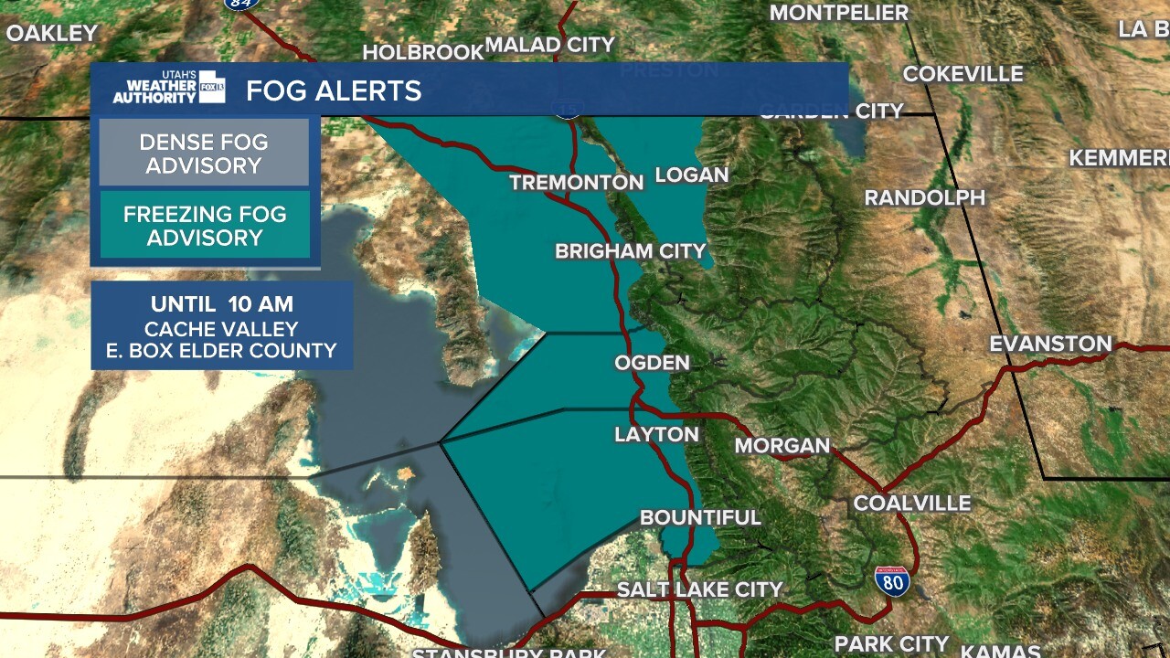
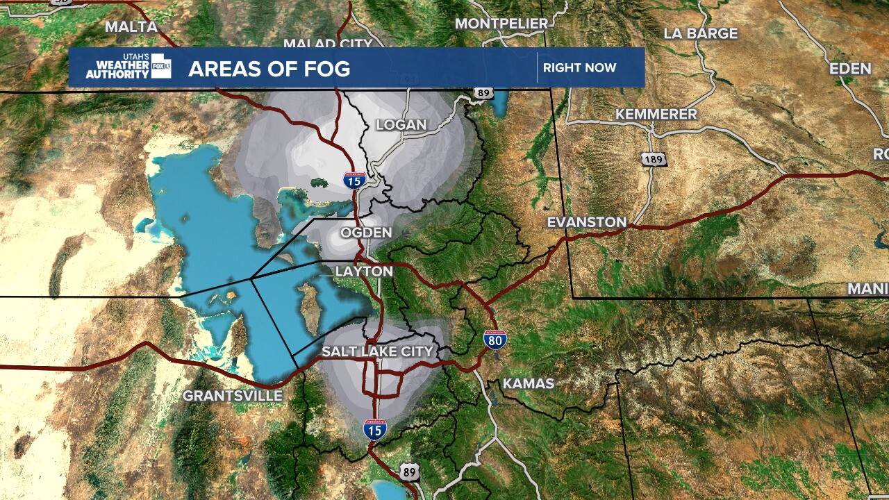
With low-level moisture in place behind the storm, widespread fog has developed mainly from Salt Lake County, stretching north into Idaho. Fog is thickest in Weber, Eastern Box Elder, and Cache counties.
Dense fog will also impact parts of Legacy Parkway and Interstate 80 near SLC International Airport. Patchy fog will likely stick around through mid-morning and then erode by midday.
Clouds will increase across the north later this afternoon & evening as the storm moves well north of Utah.
High pressure will bring warmer, dry weather through the weekend with temps climbing about 10-15 degrees above average. Valley inversions will develop with increasing haze. If inversions become strong enough, it could keep some valleys cooler than expected.
SALT LAKE CITY
Thursday: Becoming partly cloudy after patchy morning fog. Highs: Low 40s.
Thursday Night: Becoming cloudy this evening, then clearing off by morning. Lows: Upper 20s.
ST. GEORGE
Thursday: Sunny. Highs: Near 60.
Thursday Night: Clear. Lows: Lower 30s.
