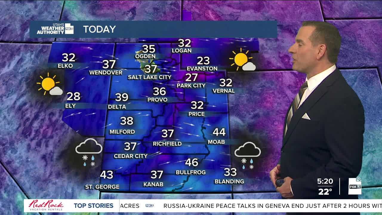


We're getting a break from the snow today, but not the cold! With chilly temps in place behind yesterday's storm, a lot of you will need your best winter coat as well as the hat & gloves! Be careful as a lot of roads and sidewalks could still be snow-covered or icy!
We'll get a little break before the next storm approaches Utah later today. This next one will track along the Arizona border from this afternoon through early Friday. Snow is expected in both the valleys & mountains and is most likely across Central & Southern Utah. Any snow in the north later tonight & early tomorrow will be relatively light and mainly south of I-80.
High pressure building back over Utah will keep it warmer & dry this weekend.
SALT LAKE CITY
Thursday: Partly cloudy & colder. Highs: Mid 30s.
Thursday Night: Mostly cloudy with a 50% chance of light snow. Lows: Mid 20s.
ST. GEORGE
Thursday: Sunny in the morning, then mostly cloudy with rain in the afternoon. Highs: Mid 40s.
Thursday Night: Rain in the evening, then mixed with snow after midnight. Lows: Near 30.
