
We remain mild and well above normal today across Utah, running about 10 to 20 degrees warmer than average. Highs along the Wasatch Front will climb close to 60 degrees, which is more typical of early April than early February. Salt Lake City’s record high for the date is 64 degrees, and there's even a chance we could tie that.

A weakening cold front will move into northern Utah late tonight and on Monday. As it approaches, it is expected to weaken, limiting how much moisture we get. The best opportunity for rain and snow will be in the northern mountains, including the Bear River Range, where light to occasionally moderate amounts are possible. Valley locations, especially south of Ogden, will likely see little to no accumulation.
Snow levels will remain relatively high, keeping most valley locations rain-only. The Cache Valley and eastern Box Elder County may briefly see a rain-to-snow mix late Monday night into early Tuesday, but any impacts should be minimal.

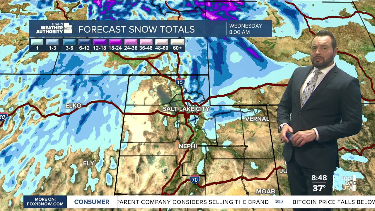
Another weather system is expected to move through Tuesday into Wednesday, bringing another chance for valley rain and mountain snow. The latest model runs continue to suggest a weaker setup than previously anticipated, although terrain-enhanced precip could still produce some decent snowfall amounts.
In the northern mountain ranges, including the Bear River Range, western Uinta Mountains, and the upper Cottonwoods, several inches of snow will be possible from Tuesday morning through late Wednesday night. Outside of these zones, snowfall amounts are expected to be more limited.

Overall, recent trends point toward lower precipitation totals, reducing the likelihood of a big snow event. Either way, we're finally getting some moisture.
