
A mix of sun and clouds will start your day statewide as a weak storm inches into the region. As it approaches, a mild southwest flow will remain in place, keeping temperatures 10–15 degrees above average.
Expect partly to mostly cloudy skies with a few sprinkles possible over northern Utah this afternoon and evening. Daytime highs will climb to near 60 degrees along the Wasatch Front and into the mid-70s for St. George.
Moist westerly flow sticks around Sunday, bringing a chance for scattered valley rain and mountain snow across northern Utah. Snow levels will remain quite high, mainly above 9,000 feet. Temperatures will stay similar to Saturday before a notable change arrives Monday.
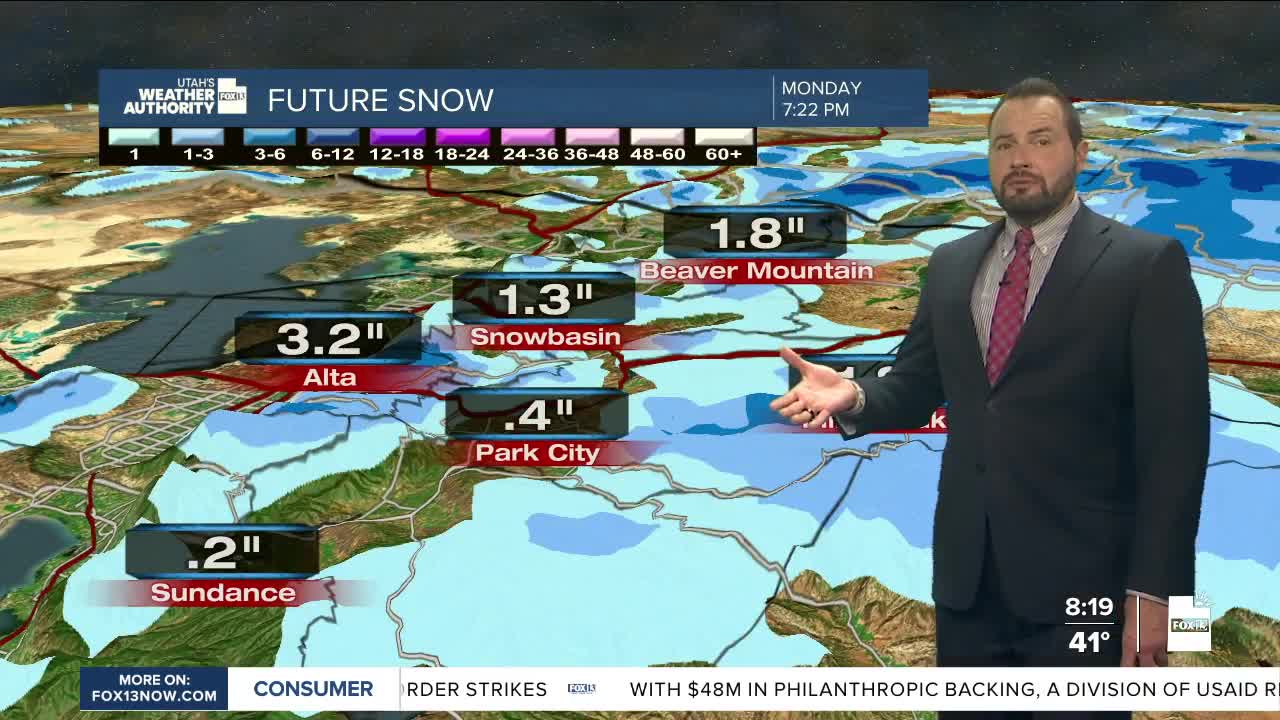
A trough of low pressure moving through will bring widespread valley rain and mountain snow throughout the day Monday, with snow levels dropping to around 7,000 feet by evening.
Rainfall totals across the northern valleys look notable, with 0.25–0.50 inches expected. Some areas, like Cache Valley, could see closer to 0.75 inches, while the mountains of northern and central Utah may pick up around an inch of water.
We’ll likely catch a break in the weather for much of Tuesday into Wednesday, before another northern Utah storm moves in late Wednesday into the Thursday timeframe.
Stay tuned!
