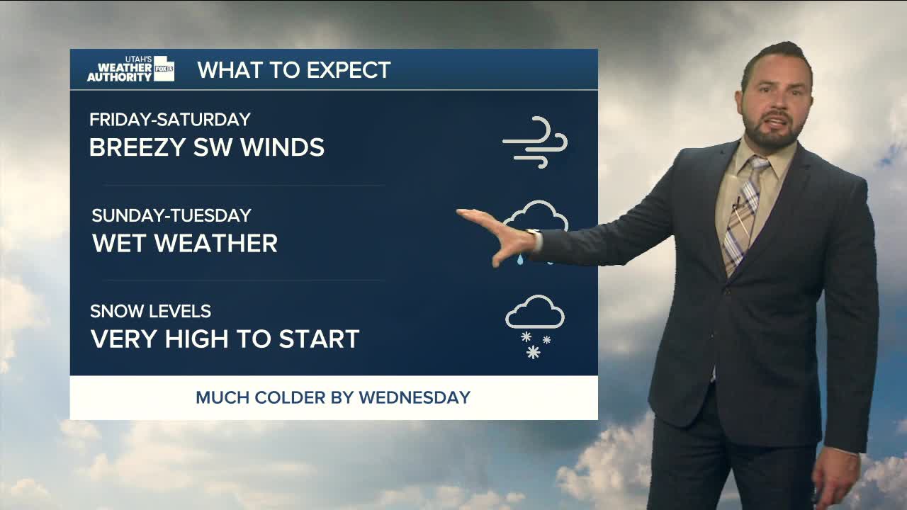

We’re heading into a pretty busy stretch of weather. A slow-moving low off the California coast — tapping into tropical moisture — is about to send a surge of moisture into the Southwest. That setup is unusual for mid-November, and it means we’ve got plenty to watch.
Southern Utah: The Main Event
Most of the action hits the southern mountains late Saturday into Sunday. Snow levels start high (around 9,500–10,000 feet) before dropping to roughly 7,500–8,000 feet by Sunday night. The heaviest snow comes Sunday morning through Sunday night, with 5–10 inches above 9,000 feet and up to a foot around Brian Head and the Tushars. Mid-elevation zones can expect 2–5 inches.
Valleys in southwest Utah will see steady rain — about a half-inch to an inch. No widespread flash flooding, but clogged storm drains and normally dry washes could cause some localized issues.
Northern & Central Utah: Cooler, but Not as Impressive
The northern piece of the system arrives later Sunday into early Monday. Moisture is still high, but storm dynamics aren’t as strong up here. Snow totals above 9,000 feet look lighter — generally 2–7 inches are expected.
Midweek: Another Storm? Maybe.
We get a small break on Monday, then models show another system trying to move in Tuesday–Wednesday. About three-quarters of the ensemble guidance favors more mountain snow… but some runs pull the storm south toward Baja, which would send the moisture well away from us. In short, potential is there, confidence isn’t.
