An active weather pattern will bring waves of precipitation to parts of the Beehive State through midweek as a storm system and associated atmospheric river move onshore in California.
The most impactful weather will be felt along and west of the Sierra Nevada Mountains in California, but remnant moisture will manage to move its way into Utah from the southwest, bringing periodic rounds of heavy mountain snow and valley rain from Monday evening through Wednesday evening.
TIMELINE
Tuesday
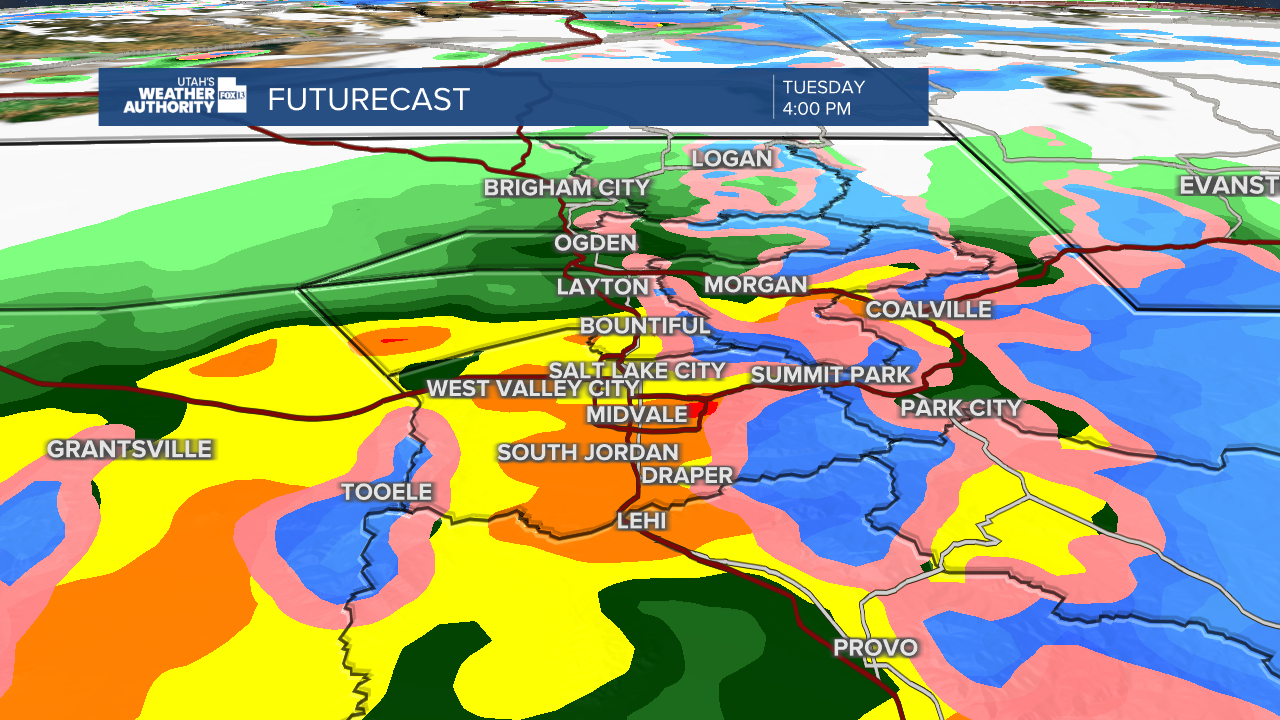
A brief break in widespread activity is forecast mid to late Tuesday morning before another round of precipitation pushes into Utah from southwest to northeast around midday, continuing into Tuesday afternoon and evening.
The entire I-15 corridor will be wet for the Tuesday evening commute, including St. George, with heavy snow along I-80 in the mountains. This round of precipitation will have remnant atmospheric river moisture, so precipitation rates are expected to be moderate to heavy at times.
Valleys will continue to see rain along with the benches and snow in the mountains above 7,000 feet. Snow levels will begin to fall Tuesday night to around 6,500 feet with colder air moving in. This will keep the valley all rain, but the high benches could see a transition to wet snow overnight Tuesday.
- Futurecast radar Tuesday late afternoon:

Wednesday
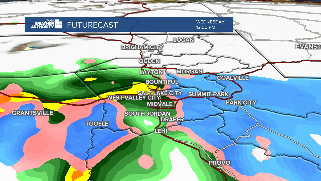
Mountain snow and valley rain will continue with widespread coverage through mid-Wednesday morning before the activity become more scattered to isolated in nature. The greatest coverage of precipitation is forecast across central and southern Utah early in the day Wednesday, shifting into northern Utah Wednesday afternoon.
Snow levels will fall from 6,500 feet early in the day to 5,500 feet by Wednesday night. Snow levels continue to fall into Thursday morning to around 4,500 feet so any lingering moisture will be snow for the benches and mountains with possibly a few wet flakes mixing in for the valley floor. The moisture will be limited beyond Wednesday, however, so the snow chances are low for the valley Thursday morning.
- Futurecast radar Wednesday midday:

IMPACTS
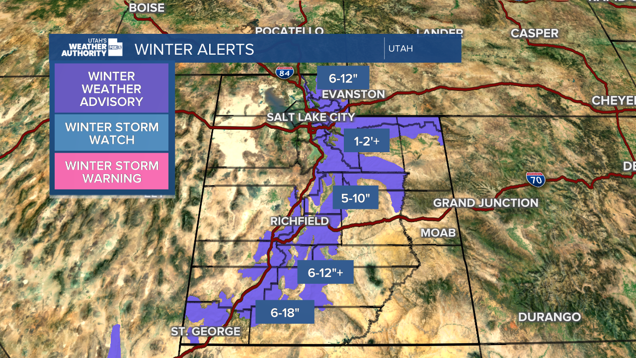
Because of the expected impacts, the Salt Lake City National Weather Service issued Winter Weather Advisories for the northern, central and southern Utah mountains.
The Winter Weather Advisory kicks into effect for the northern mountains Monday evening and continues through Wednesday evening. The northern mountains are forecast to receive 6-12 inches of snow by Wednesday night north of I-80. Just south of I-80, the Central Wasatch Range—this includes the Cottonwoods, will receive 1-2 feet of snow.
The Winter Weather Advisory kicks into effect for the central and southern mountains Tuesday afternoon, continuing through Wednesday evening. The central and southern mountains are forecast to receive 6-12 inches of snow with higher amounts around 18 inches at Brian Head.
- Winter Weather Alerts and snow accumulation forecast:

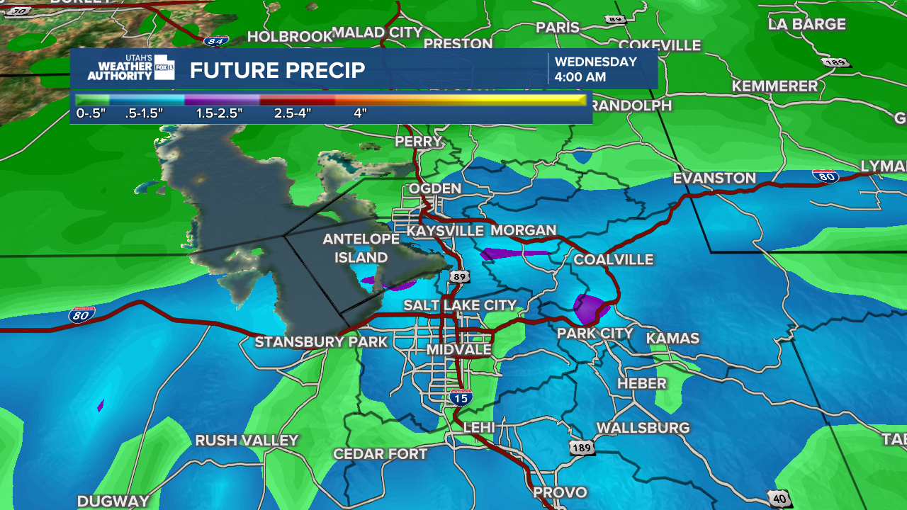
The valleys will pick up half an inch to 1 inch of rain by the end of the day Wednesday. The Salt Lake City Metro will see around 1 inch of rain.
- Rain accumulation forecast:


