

Time to dust off the snow-scrapers!
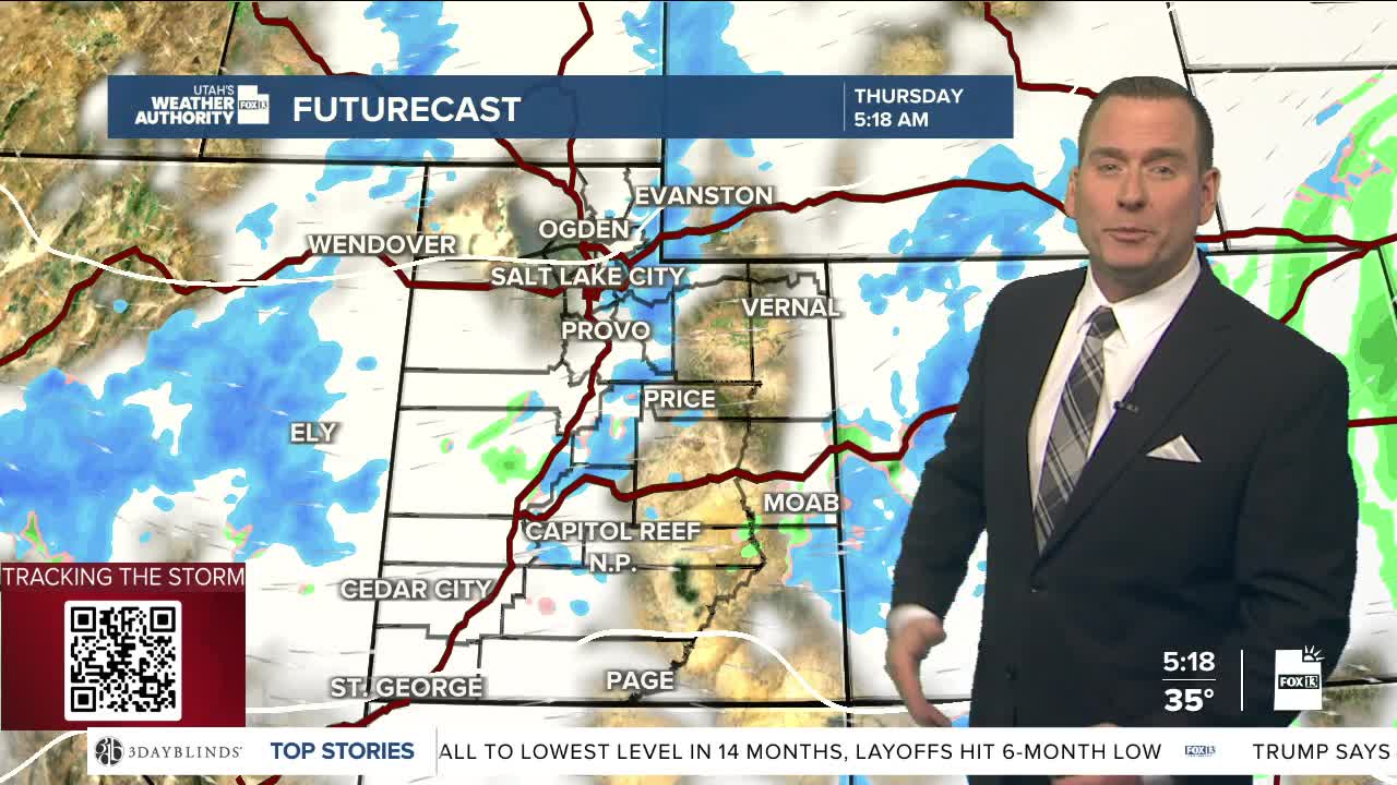
A cold front will slide south across Utah today, bringing widespread snow. Accumulations are expected in the valleys as well as the mountains and will have impact on travel.
Snow is most likely across the north during the morning, then across southern Utah this afternoon. Even though there will be a lull in precipitation across the north before sunrise, snow showers will re-develop before the end of the morning commute. The wild card is if any lake develops. If that plays out, heavy snow showers will be possible in the Salt Lake Valley.
Snow decreases this afternoon & there will likely be just a slight chance this evening. As of now, winter weather alerts will expire this evening.
High pressure will build this weekend, keeping it dry. Inversions are expected to develop, but there's still some uncertainty as to how strong they might be. At the very least, plan on cutting back on driving if you can!
SALT LAKE CITY
Thursday: Mostly cloudy & colder with snow likely in the morning, then a chance of snow in the afternoon. Highs: Upper 30s.
Thursday Night: Much colder with snow showers decreasing. Becoming partly cloudy after midnight. Lows: Lower 20s.
Friday: Partly cloudy with a slight chance of snow in the morning. Highs: Mid 30s.
ST. GEORGE
Thursday: Mostly cloudy with rain showers along with a slight chance of thunderstorms, mainly in the morning. Highs: Mid 40s.
Thursday Night: Clear & colder. Lows: Mid 20s.
Friday: Sunny. Highs: Low 40s.
