Weather

Actions

Another round of sunshine

Saturday Morning Weekend Forecast
Posted

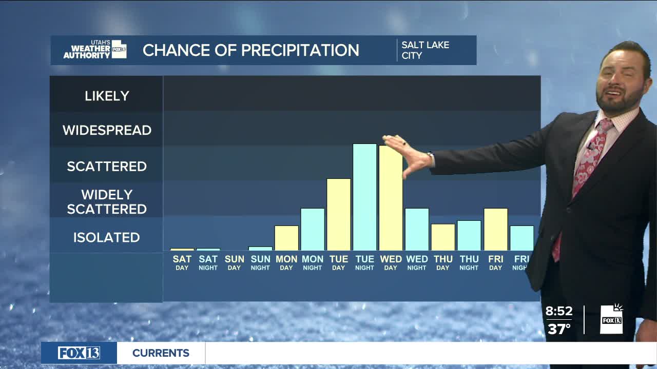
Another round of sunshine above normal temperatures for today, so enjoy the warmth while it lasts. Temperatures stay 10 to 15 degrees above normal through the weekend, but a more active weather pattern moves in next week.

Graphics from the FOX 13 Weather Center showing the path of the cold front, which blows in from the northwest and remains localized around the northern part of Utah.

A weak cold front arrives Monday with limited moisture, mainly for the northern mountains. The better chance for widespread rain and mountain snow comes Tuesday through Wednesday, when most of the state could pick up a decent amount of moisture.

Graphics from the FOX 13 Weather Center showing the predicted snowfall by Thursday night. Much of southern Utah remains dry. Northern Utah is expected to receive an average of 1 to 3 inches of snow, with some spots at higher elevations predicted to receive between 6 to 12 inches.

While snowfall amounts are still early guesstimates this far out, the Northern Utah mountains should see 5-10", or more, of snow, while central and southern mountains are less likely to see significant accumulations. Valley snow chances remain low with mainly rain expected.

Graphics from the FOX 13 Weather Center showing the chances of precipitation for the Salt Lake City area. It remains below Isolated Showers through Monday, rising up to Widespread Showers by Tuesday night into Wednesday before dropping back down to Widely Scattered by Friday.

Unsettled weather may linger into Thursday before conditions quiet down again heading into the next weekend. Stay tuned.

REAL-TIME WEATHER: Get the latest weather forecasts by downloading the FREE Utah Weather Authority app