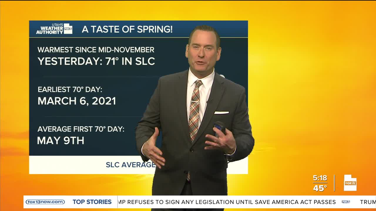


After a warm start to the week, a mostly dry cold front will make it feel like late-winter again today & tomorrow. Temps will drop about 7-15 degrees lower than Monday across Northern Utah, but that'll still keep it pretty close to average for early March. Temps will be about 2-8 degrees cooler across the south.
It's going to be breezy today with West / NW winds gusting near 40 mph in the Uinta Basin, SW Wyoming, & along the ridge lines of the northern mountains.
Cool air will linger tomorrow, but temps will climb well above average again by the second half of the week. Warm weather will stick around through at least the middle of next week.
SALT LAKE CITY
Tuesday: Partly cloudy & cooler. Highs: Mid 50s.
Tuesday Night: Clear & cold. Lows: Lower 30s.
ST. GEORGE
Tuesday: Sunny. Highs: Low 70s.
Tuesday Night: Mostly clear. Lows: Mid 40s.
