


The first storm of November is bringing snow, along with cold and wet weather to Utah and southwest Wyoming on Wednesday; with wintry conditions expected through Thursday.
TRACK THE STORM: Get real-time storm information by downloading the FREE Utah Weather Authority app
Up to 6 inches of snow accumulation is possible for more valleys and benches in the northern portion of the state, while the mountains could see 6-12 inches, with 18 inches possible. A traction law is now in effect for both Big and Little Cottonwood canyons.
Snow will gradually diminish after midnight.
Anyone on the road is asked to prepare for winter driving conditions with low visibility and slick roadways, while larger vehicles may have traction restrictions on mountain routes.
A Winter Weather Advisory has been issued for all mountain zones and southwestern valleys. Snow is expected to start falling Wednesday morning, with the following accumulations:
- Northern mountains: 3-10 inches with locally higher amounts
- Central and southern mountains: 6-12 inches, locally higher
- Southwest valleys (not Lower Washington Co.): 2-6 inches
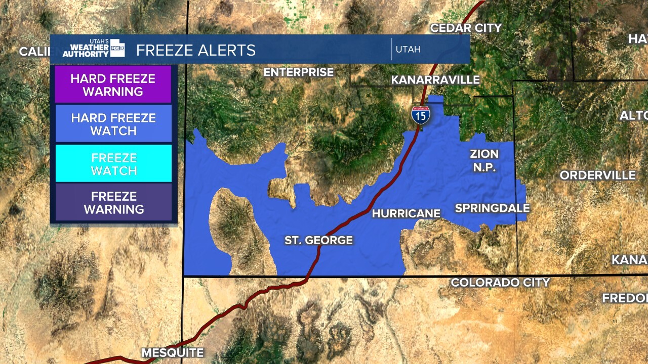
The National Weather Service said a Hard Freeze Watch will begin for areas of southwest Utah on Thursday night, including lower Washington County and Zion National Park. Sub-freezing temperatures as low as 25 degrees are possible through Friday morning.
SALT LAKE CITY
Wednesday: Getting colder with rain & snow likely. 1-3 inches on benches. Afternoon temps: Low to Mid 40s.
Wednesday Night: Snow showers. 1-2 inches on benches, minor accumulation on grassy surfaces in the valley. Lows: Mid 30s.
ST. GEORGE
Wednesday: Becoming cloudy with rain likely in the afternoon. SW winds 15-25 mph in the afternoon. Highs: Low 60s.
Wednesday Night: Colder. Rain likely. Lows: Near 40.
