

Mainly sunny and hazy Sunday with temperatures near average highs statewide. Areas of central and eastern Utah will continue to see impacts from wildfire smoke.
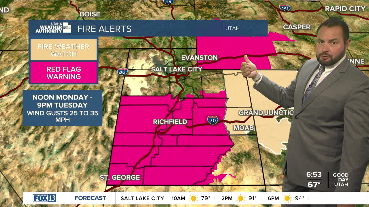
On Monday, Red Flag Warnings go back into effect for much of central and southern Utah as gusty winds and low relative humidity return. The warnings will start at noon on Monday and remain in place through 9 pm Tuesday. Wind gusts up to 35 mph are expected, with relative humidity down to 5%. Wildfires will explode in size under these conditions. Make sure you are Firewise and avoid anything that could spark a new blaze.
Temperatures will remain close to seasonal averages early in the week, climbing midweek under strong south flow. Valleys of northern Utah will be flirting with triple-digit temperatures on Wednesday and Thursday.
SALT LAKE CITY
Sunday: Sunny and Hot. Highs: Mid 90s.
Sunday Night: Mostly Clear. Lows: Near 70.
Monday: Mostly Sunny. Highs: Near 97.
Tuesday: Sunny skies. Highs: Near 94.
ST. GEORGE
Sunday: Hot and Sunny. Highs: Near 104.
Sunday Night: Mostly Clear. Lows: Near 70.
Monday: Hot and Mostly Sunny. High: Near 103.
Tuesday: Very hot and Partly Cloudy. High: Near 105.
