

After a dry January, we're finally getting a chance of snow! It's not much, but we'll take what we can get!
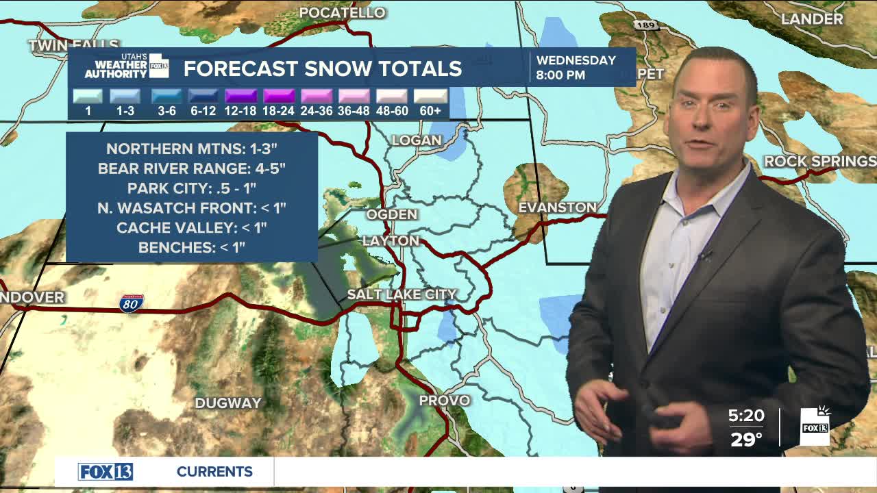
A weak storm will graze northern Utah this afternoon. It has enough moisture to work with that there could be modest, measurable snowfall. Up to 1-3 inches are possible in the northern mountains, with a little more possible over the Bear River Range.
There's a chance of measurable snowfall (at least 0.1") along the northern Wasatch Front, Cache Valley, and the benches. There could be around a half-inch along the Wasatch Back in places like Park City, while the Salt Lake Valley will likely just get flurries.
High pressure will build back over the area on Thursday, with warmer, drier weather through the weekend and at least into the middle of next week.
SALT LAKE CITY
Wednesday: Mostly cloudy with a chance of light snow in the afternoon, mainly flurries. Highs: Mid 40s.
Wednesday Night: Partly cloudy. Lows: Upper 20s.
ST. GEORGE
Wednesday: Becoming sunny after morning clouds. Highs: Near 60.
Wednesday Night: Mostly clear. Lows: Near 30.
