
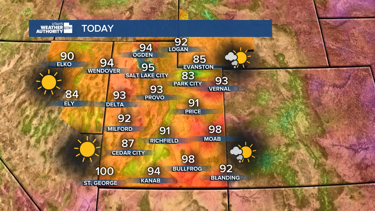
Calm and mostly clear early Sunday, with typical hot temperatures returning this afternoon. Daytime highs will be similar to those on Saturday, with mid-90s expected for the Wasatch Front and near 100 degrees for St. George.
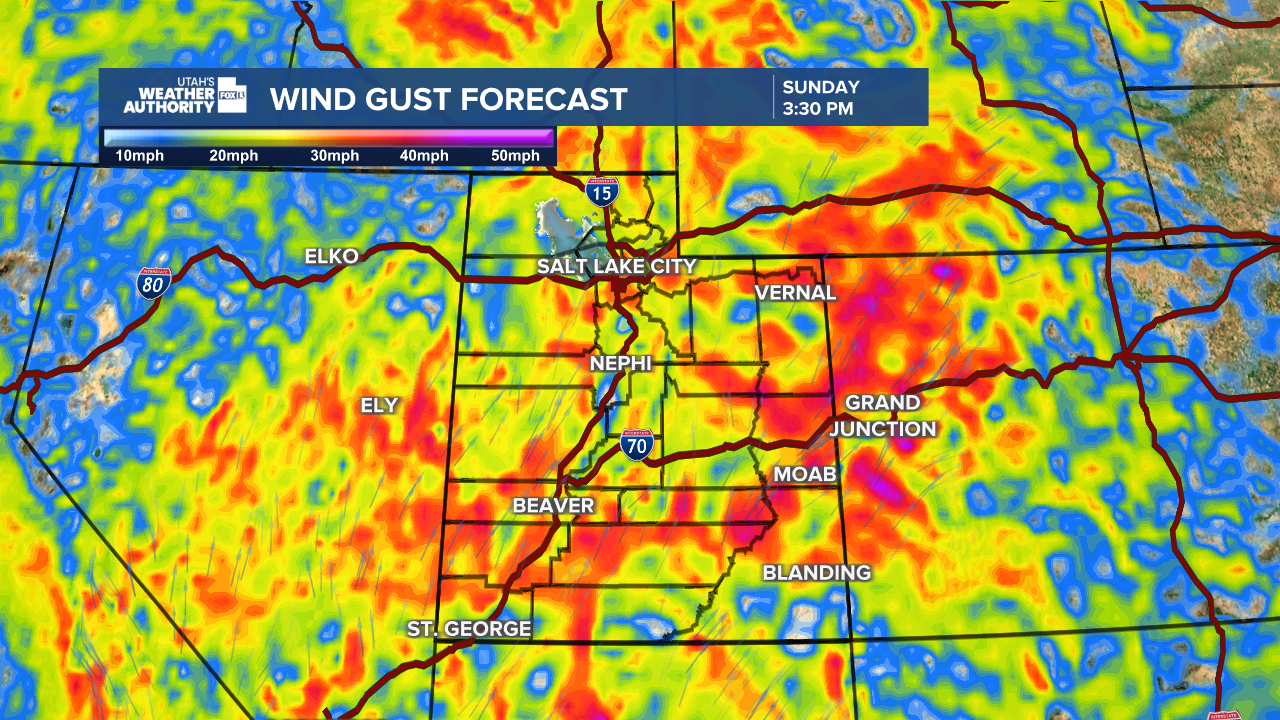
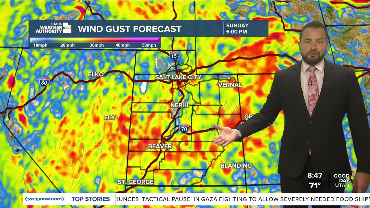
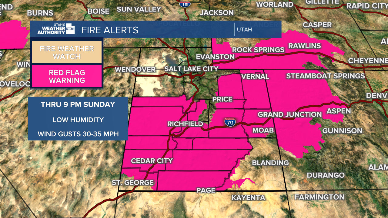
Critical fire weather remains in place for most of the state with strong wind gusts again this afternoon. Wind gusts up to 35 mph are expected with relative humidity down to 6%. Red Flag Warnings are in place through 9 pm Sunday.
Little change is expected in the next week, with mainly hot and dry weather continuing. Peak heat will arrive on Tuesday, where highs will reach the upper 90s for the northern valleys, near 104° in St. George.
This means that wildfire conditions will remain elevated early in the week with gusty winds returning each afternoon. The forecast is hinting at some moisture moving into the region by Wednesday-Thursday, which could lead to isolated showers and thunderstorms across portions of southern Utah. Stay tuned.
SALT LAKE CITY
Sunday: Mostly Sunny and Hot. Highs: Mid 90s.
Sunday Night: Mostly Clear. Lows: Near 70°.
Monday: Mostly Sunny. Highs: Near 97°.
Tuesday: Hot and Mostly Sunny. Highs: Near 98°.
ST. GEORGE
Sunday: Hot and Sunny. Highs: Near 100°.
Sunday Night: Partly Cloudy. Lows: Near 70°.
Monday: Hot and Sunny. High: Near 104°.
Tuesday: Hot and Sunny. High: Near 104°.
