
Mostly sunshine and slightly warmer temperatures are in store for Sunday. Weaker temperature inversions will continue through at least Monday, which should help limit how bad haze gets across the northern Utah valleys. Air quality won’t be perfect, but conditions should remain better than what we typically see during stronger inversion events.

That said, haze is expected to slowly return to the area into the work week. Moderate to Unhealthy for Sensitive Groups will likely return late Tuesday into Wednesday while high pressure remains in place.

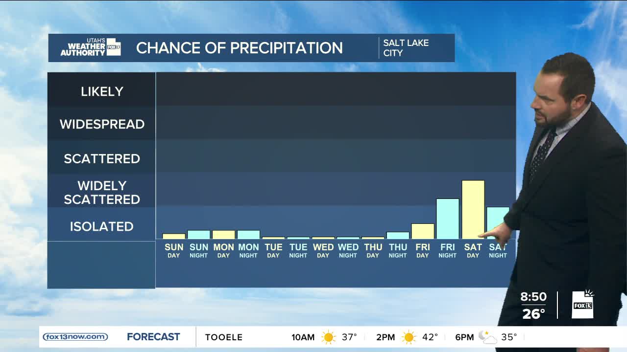
Looking ahead, the next chance for rain or snow across northern Utah arrives late next week, sometime between Friday and Sunday. Most forecast models show measurable precipitation with the next storm cycle; lighter amounts showing up this far out. While the exact timing is still uncertain, this system should be cold enough to help clear out any remaining valley pollution.
It’s still too early to talk specific snow totals, but at this point snowfall in the northern mountains looks to be somewhere in the 3-6" range. No blockbuster storm on the horizon — just a typical late-week winter system trying to do a little cleanup duty.
