

It felt like spring yesterday, but a later winter storm is moving through today & tomorrow!
The storm moved in overnight, but is splitting apart. As a result, precipitation will wind down the morning. Then, after a break much of the day, rain & snow will fill back in this evening & linger into midday Friday.
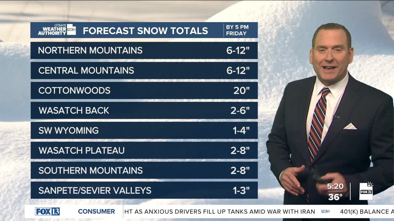
Heavy mountain snow is possible with mainly a rain/snow mix in the valleys. Accumulating valley snow is most likely in Sanpete & Sevier valleys with minor accumulations possible elsewhere. At the very least, be prepared for wet roads tonight & for the Friday morning commute.
It's going to dry out & warm up this weekend with mild weather lingering at least through early next week.
SALT LAKE CITY
Thursday: Mostly cloudy & cooler with rain & snow showers. After a break during the middle of the day, showers fill back in by late afternoon & evening. NW winds 10-20 mph. Highs: Low 40s.
Thursday: Rain & snow likely with minor accumulations possible. Lows: Lower 30s.
ST. GEORGE
Thursday: Slight chance of early morning showers, then becoming sunny. North winds 10-20 mph, stronger near the canyons. Highs: Near 60.
Thursday: Mostly clear. Lows: Upper 30s.
