

Your AC unit can finally take a vacation!
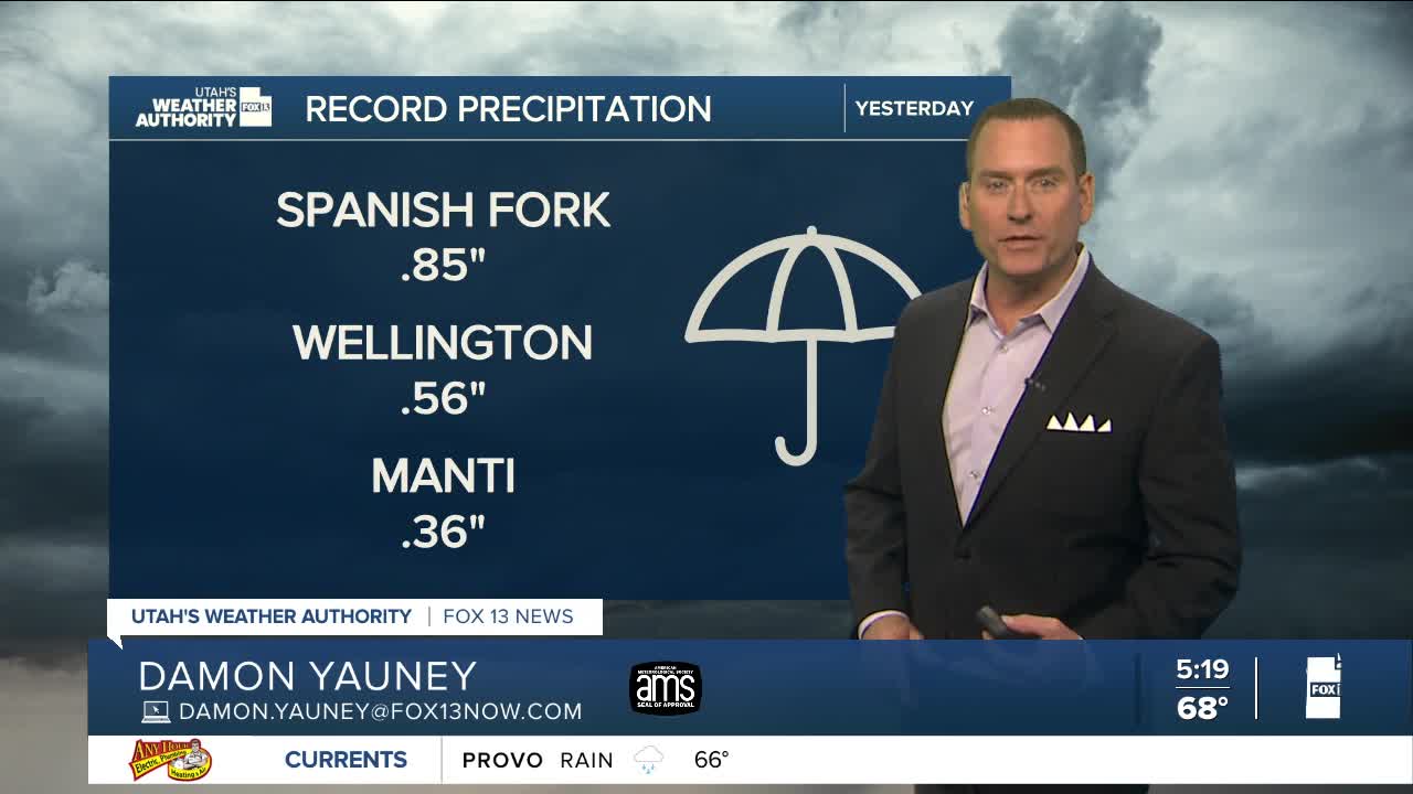
Showers & t-storms will continue across most of Utah today with heavy rain possible at times. But with dry air starting to move back into the south, t-storms will be most likely across Central & Northern Utah this afternoon & evening. Any storms could bring heavy rain, so flash flooding is still a threat.
Besides getting much needed precipitation, you're finally getting a break from the late summer heat! In fact, temps will be running about 6-12 degrees below average today.
Wet weather is possible again tomorrow & Friday, but a gradual warming & drying trend is expected heading into weekend.
SALT LAKE CITY
Wednesday: Mostly cloudy & cooler. Showers are likely along with a chance of t-storms. Highs: Upper 70s.
Wednesday Night: Chance of showers & t-storms in the evening, then decreasing after midnight. Lows: Mid 60s.
ST. GEORGE
Wednesday: Partly cloudy with a 40% chance of showers & t-storms. Highs: Near 90.
Wednesday Night: Partly cloudy with a slight chance of showers & t-storms in the evening.
