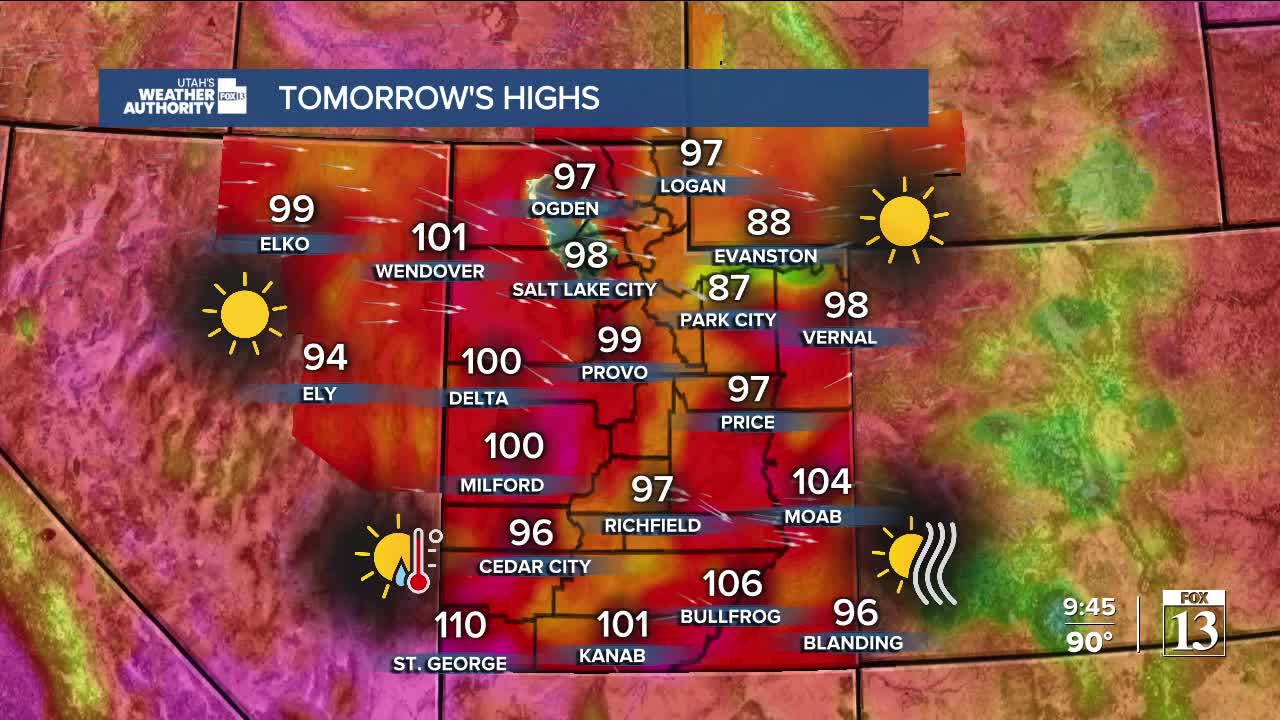


Extremely hot temperatures are taking over Southern Utah for the next few days. Daytime highs this afternoon are expected to climb to 109 degrees in St. George, up to 110+ by Monday.
Due to the dangerously hot weather, Extreme Heat Warnings have been issued for Lower Washington County on Monday from noon to 10 pm. Heat-related illnesses significantly increase when temperatures are this hot. Limit time outdoors, drink plenty of fluids, and check on pets and the elderly.
In northern Utah, we're looking at similar conditions to yesterday. The main difference will be temperatures that are climbing a few degrees from Saturday. Heat will continue to build statewide early into the work week, with highs near 100 degrees in Northern Utah by Monday and Tuesday.
A weak dry front should slide through Northern Utah midweek and drop temperatures a bit, staying near normal highs, with little to no chance of rain.
Rain chances will increase later in the week with another potential surge of monsoonal moisture. The increase in cloud cover and chance of storms should help take the edge off the extreme heat towards the end of the week.
SALT LAKE CITY
Sunday Night: Mostly Clear. Lows: Near 70.
Monday: Mostly Sunny. Highs: Upper 90s.
Tuesday: Very Hot & Partly Cloudy. Highs: Upper 90s/near 100.
ST. GEORGE
Sunday Night: Mostly clear. Lows: Near 80.
Monday: Sunny & very hot. Highs: Near 110. (Record 112 from 1972)
Tuesday: Sunny & very hot. Highs: Near 107.
