

We're not done with the wet weather yet!
Valley rain & mountain snow will taper off by mid-morning, so after a wet commute for some of you we'll get a bit during the middle of the day. But then showers get going again this afternoon & evening along with a slight chance of t-storms. Snow will mainly be above 7,500 ft and could be heavy at times between 2 and 6 pm. An additional 1-4 inches is expected in the northern mountains with another couple inches possible in the Wasatch Plateau.
By Friday, most showers will be across SE Utah. Otherwise, high pressure building over Utah will give us a break from the storms and keep it mild & dry this weekend.
Another series of storms will start to move back in early next week.
SALT LAKE CITY
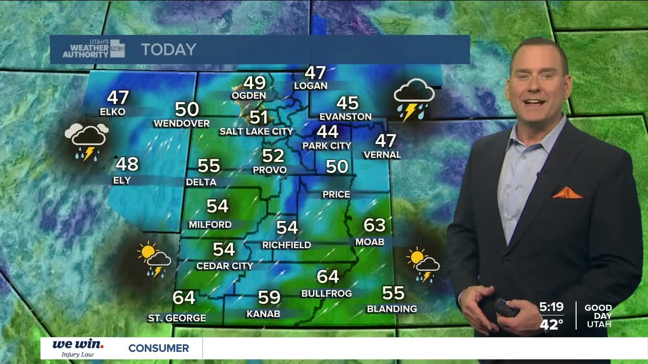
Thursday: Mostly cloudy with rain likely in the morning. Then after a midday break, more rain & isolated t-storms in the afternoon. Highs: Near 50.
Thursday Night: Mostly cloudy with decreasing rain showers. Lows: Mid 30s.
ST. GEORGE
Thursday: Partly cloudy with a slight chance of showers & thunderstorms in the afternoon. Highs: Mid 60s.
Thursday Night: Mostly cloudy. Lows: Lower 40s.
