


It might be spring, but you still need a winter coat!
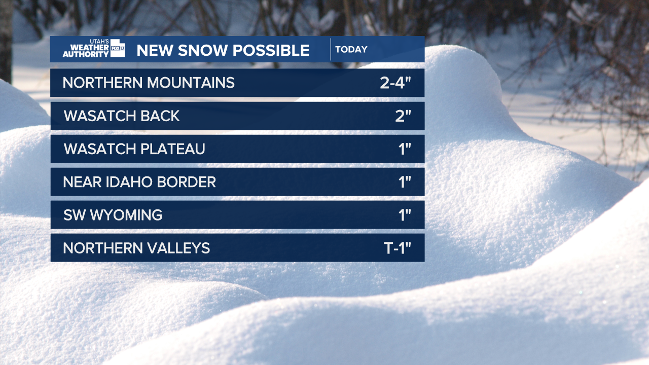
More snow is expected across Northern Utah today, although it should be lighter than on Monday and Tuesday. Showers will be most likely from late morning into the afternoon. Isolated thunderstorms will also be possible.
Temperatures will gradually warm up over the next few days. With that being the case, light showers in the valleys tomorrow will be rain with snow in the mountains. Warmer, dry weather is forecast for Friday.
SALT LAKE CITY
Wednesday: Mostly cloudy with a 60% chance of snow showers, but with little or no accumulation expected on the valley floor. Slight chance of afternoon t-storms. NW winds 10-20 mph. Highs: Mid 40s.
Wednesday Night: Mostly cloudy with snow showers most likely in the evening, then just a slight chance overnight. Lows: Near 30.
ST. GEORGE
Wednesday: Sunny. West winds 10-20 mph in the afternoon. Highs: Low 60s.
Wednesday Night: Mostly clear. Lows: Mid 30s.
