
A mild and moist storm system will move into Utah late today and continue through Monday, bringing valley rain and significant mountain snow. The heaviest precipitation is expected late tonight through Monday morning across northern Utah, with slick and snowy travel likely on mountain routes.
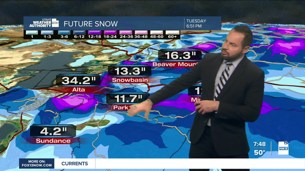
Snow levels will stay relatively high at first, around 7,000 feet, before dropping closer to 6,000–6,500 feet on Monday. The northern mountain areas are under a Winter Weather Advisory through 11 pm Monday and are expected to see 8 to 18 inches of snow by Monday evening, with locally higher amounts possible.
Valleys along the northern Wasatch Front, Cache Valley, and the Wasatch Back will see the best chance for rain, while Salt Lake and Tooele Valleys may not see widespread precipitation until late tonight.
Precipitation gradually tapers off Monday afternoon and evening. Tuesday brings a brief break in the action, with milder temperatures continuing and only a slight chance of lingering mountain snow showers across northern Utah.
The pattern turns more active again midweek as colder storm systems arrive. The first system is expected late Wednesday into early Thursday, bringing falling snow levels and accumulating snow in the mountains, with a chance for valley snow across northern Utah by Wednesday night.
A second, colder system Thursday into early Friday may allow snow to reach valley floors, especially along the northern Wasatch Front and bench areas; fingers crossed the storm pans out. Stay tuned.
