Weather

Actions

Much-needed moisture moving through Wasatch Front

Sunday Morning Weather Forecast
Posted
and last updated
Graphics from the FOX 13 Weather Center showing the hour-by-hour forecast for Salt Lake City. 9 AM shows scattered thunderstorms with a temperature of 77°, 11 AM shows thunderstorms with a temperature of 78°,  1 PM shows cloudy with a temperature of 81°, 3PM shows mostly cloudy with a temperature of 83°, 5 PM shows partly cloudy with a temperature of 85°, and 8PM shows partly cloudy with a temperature of 82°.
Graphics from the FOX 13 Weather Center showing the hour-by-hour forecast for St. George. 10 AM shows partly cloudy with a temperature of 86°, NOON shows partly cloudy with a temperature of 92°, 2PM shows partly cloudy with a temperature of 96°, 4PM shows partly cloudy with a temperature of 99°, 6PM shows partly cloudy with a temperature of 100°, and 8 PM shows partly cloudy with a temperature of 96°.

Grab the umbrellas as you head out this morning! We have much-needed rain moving through parts of the Wasatch Front early this morning, with a chance of isolated thunderstorms this afternoon.

Graphics from the FOX 13 Weather Center that shows the Excessive Rain Outlook for the state. Much of Utah remains in Marginal status with isolated flash floods, but a stretch spanning from Beaver to St. George, and stopping west of Blanding shows Slight status with scattered flash floods.

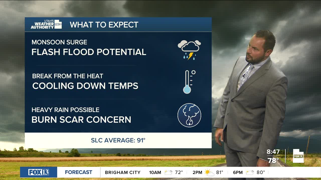
Showers are lifting northeast throughout the day and will help keep temperatures from climbing back into the 90s for northern Utah valleys this afternoon. Southern Utah will also see storms, with heightened flash flood potential for today due to increased monsoon moisture in the region.

Graphics from the FOX 13 Weather Center showing the flash flooding potential for Utah's slot canyons. All canyons show a "Probable" change for flash floods.

All recreation areas down south have a 'Probable' Flash Flood Potential risk today, meaning some slot canyons and dry streams are expected to have flash flooding. Stay out of slot canyons, low-lying areas, and normal dry washes today.

Graphics from the FOX 13 Weather Center showing the path of the high pressure front, which hangs to the southeast of the state. Patches of white, green, and yellow show areas expected to experience isolated showers, most of it localized due south of Capitol Reef National Park.

Active weather will continue in the first half of the week as moisture remains in place. The potential for isolated to scattered showers and thunderstorms will remain possible each afternoon statewide, with cooling temperatures through midweek.

Graphics from the FOX 13 Weather Center showing the predicted high temperatures for the state. From top to bottom, left to right: Elko 86°, Wendover 88°, Ogden 85°, Logan 83°, Salt Lake City 88°, Evanston 74°, Park City 74°, Vernal 86°, Ely 85°, Delta 91°, Provo 86°, Price 83°, Milford 91°, Richfield 84°, Moab 92°, Cedar City 85°, St. George 100°, Kanab 91°, Bullfrog 95°, Blanding 85°

Daytime highs will drop in the low 80s for northern Utah valleys, with southern Utah expecting highs in the low 90s by Tuesday. An increase in westerly flow by the end of the week will nudge moisture to the east, bringing less of a threat for afternoon thundershowers through Friday.

Temperatures will start to rebound, as well, to near average highs by Saturday.

REAL-TIME WEATHER: Get the latest weather forecasts by downloading the FREE Utah Weather Authority app