

Mild & dry today, but we're going to ring in the new year with wet weather!
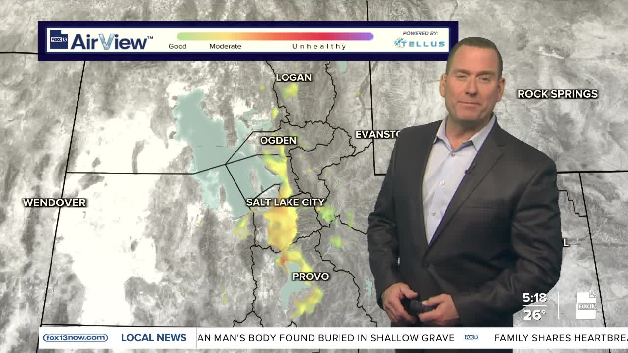
As chilly as it might feel, high pressure over Utah will help temps climb above average across most of the area. That warm-up will be muted in some of the northern valleys socked in with cold air because of the inversion. Poor air quality is expected again today, but an active weather pattern should bring big improvement over the next few days.
Valley rain & high elevation mountain snow will move in tonight and become widespread by early New Year's Day. Freezing rain is possible in some of the colder valleys and could cause icy roads early tomorrow. It's most likely in the NW deserts and could impact parts of I-80 between Salt Lake & the Nevada border. Freezing rain is also possible in Castle Country & parts of the US 89 corridor east of Kanab.
Most snow will be in the mountains with 2-8 inches expected above 8,000 ft.
SALT LAKE CITY
Wednesday: Partly cloudy. Highs: Low 40s.
Midnight: Mostly cloudy & in the mid 30s. Rain likely after midnight.
New Year's Day: Rainy & slightly warmer. Highs: Mid to Upper 40s.
ST. GEORGE
Wednesday: Partly cloudy in the morning, then becoming cloudy in the afternoon. Highs: Mid 50s.
Midnight: Cloudy & cool with showers likely. Temps: Upper 40s.
New Year's Day: Rain likely. Highs: Low 50s.
