

Just like yesterday, most storms that develop today will be over
Southern and Eastern Utah. Any of the storms could bring heavy rain and lead to flash flooding. Isolated storms are possible across the north this afternoon, but as dry air moves in this evening those will taper off.
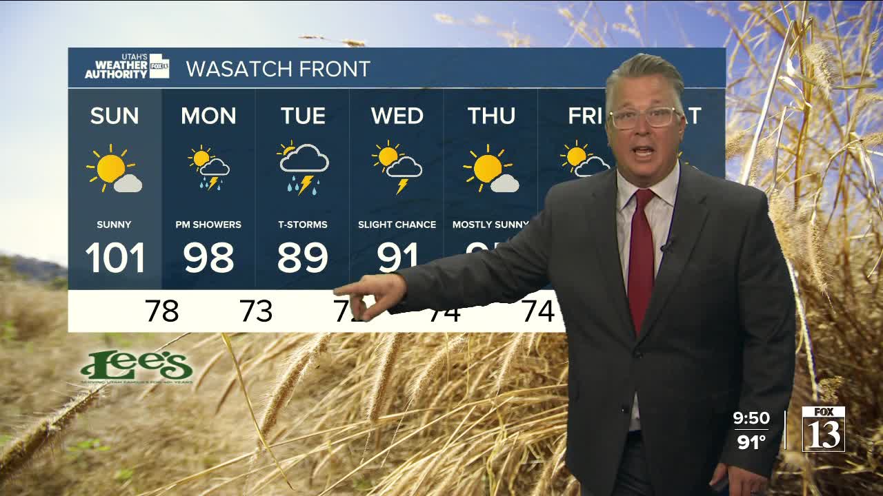
Monsoonal moisture will stay in place and fuel more thunderstorms across the south this weekend, while Northern Utah will be hot and dry.
Deeper moisture is expected to spread back north early next week and bring a better chance of wet weather to Northern Utah.
SALT LAKE CITY
Friday: Becoming partly cloudy with a 20% chance of showers & t-storms. Highs: Upper 90s.
Friday Night: Mostly clear. Lows: Mid 70s
Saturday: Sunny. Highs: Upper 90s.
Sunday: Sunny. Highs: Near 101.
ST. GEORGE
Friday: Partly cloudy. 50% chance of scattered showers & t-storms. Highs: Upper 90s.
Friday Night: Mostly cloudy with decreasing showers & t-storms. Lows: Mid 70s.
Saturday: Partly cloudy with scattered PM showers & t-storms. Highs: Mid 90s.
Sunday: Partly cloudy. Scattered PM showers & t-storms. Highs: Mid 90s.
