
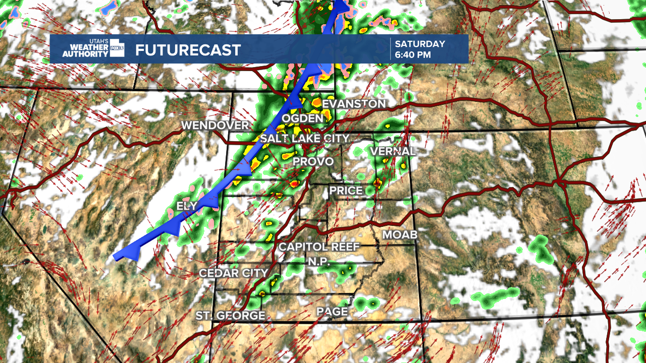
A strong southwesterly flow is setting the stage for another active weather day across Utah. We're seeing fairly calm conditions across the state as we start the day, but don’t let this morning lull fool you, another round of storms is expected to fire up this afternoon as a cold front moves through.

The Storm Prediction Center has placed nearly the entire state under a Marginal Risk for severe weather today, meaning a few storms could pack a punch with strong winds, hail, and heavy rain. While heavy rainfall is possible statewide, the focus shifts north through the day.

Northern Utah can expect widespread showers and storms late this afternoon into tonight, particularly along the cold front, some storms could be severe. Southern Utah will see fewer widespread downpours and more scattered, individual showers, a change from the soaking rains of the past couple of days.

The cold front will continue sweeping south through Utah overnight, ushering in much colder air. Snow levels will tumble quickly — down to around 6,500 feet by early Sunday morning. Our mountains won't see much in the way of accumulating snowfall...a few inches are expected with slightly higher amounts for the Upper Cottonwoods.
By Sunday morning, rain and snow will taper off, leaving behind cooler, much drier conditions. However, the break won’t last long. Temperatures begin to warm again Monday as southwest flow strengthens ahead of another slow-moving storm system sliding down the West Coast.
Moisture will start to increase over southeast Utah Monday into Tuesday, bringing a few showers back into the mix. That system is expected to move across Utah Wednesday and Thursday, bringing another round of showers, thunderstorms, and cooler temperatures to finish out the week.
