

The last weekend of September is going to be a warm one! Temps won't climb as high as yesterday, but it's still going to be well above average.
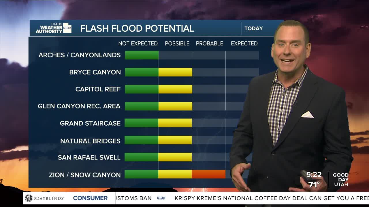
Moisture moving in from a slow-moving storm over the Desert SW will bring a chance of more showers & t-storms. They're most likely in Southern Utah again today & tomorrow, but could pop up in the north, mainly over the higher terrain.
By Sunday, wet weather will expand across the north & east.
SALT LAKE CITY
Friday: Partly cloudy with a 30% chance of showers and a slight chance of thunderstorms. Highs: Near 80.
Friday Night: Mostly clear. Lows: Upper 50s.
Saturday: Sunny & still warm. Highs: Low 80s.
Sunday: Partly cloudy with a 50% chance of showers & t-storms. Highs: Upper 70s.
ST. GEORGE
Friday: Partly cloudy with a 50% chance of showers & t-storms. Some t-storms may produce heavy rainfall. Highs: Mid to upper 80s.
Friday Night: Partly cloudy with showers decreasing in the evening. Lows: Mid 60s.
Saturday: Partly cloudy with a 50% chance of showers & t-storms. Highs: Mid 80s.
Sunday: Partly cloudy with a 50% chance of showers & t-storms. Highs: Near 80.
