
We're settling into another stretch of well above normal temperatures, with highs running 15 to 20 degrees warmer than average through at least Tuesday. Not exactly the postcard version of winter—and yes, the calendar still insists it’s December.
A few weak weather systems will move through northern Utah and southwest Wyoming from Sunday into Monday, bringing light valley rain and high-elevation snow, mainly near the Utah–Idaho border.

Snow levels will be unusually high, rising from around 7,000–8,000 feet Sunday morning to near 9,500 feet by the afternoon, limiting snow impacts to the highest peaks. Overall precipitation amounts will be light, with no real travel concerns.

By Tuesday, most areas dry out as this moisture shifts north, giving Utah a brief break from precipitation.
Meanwhile, breezy winds will continue at times through Tuesday, especially across western Utah, with gusts reaching 25–35 mph. While not extreme, it may be enough to rearrange patio furniture or remind you why you hate driving high-profile vehicles.

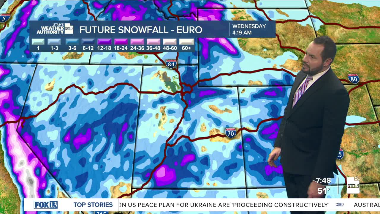
Looking ahead to midweek, a stronger Pacific storm system arrives Wednesday through Friday. This system will tap into an atmospheric river, bringing widespread rain in the valleys and mountain snow, though—once again—snow levels stay high due to the warm nature of the storm. Winds will also ramp up, becoming stronger and more widespread, particularly on Wednesday.
Temperatures remain unusually mild through Thursday before cooling slightly Friday—though even then, readings stay above normal.
And finally, the stat no snow lover wants to hear: Salt Lake City still has no measurable snowfall, and we’re inching closer to the record for the latest first measurable snow on record. That mark currently sits at January 2nd. Winter may eventually show up—but right now, it’s clearly running late and missing its cues.

