


A stormy start to the weekend!
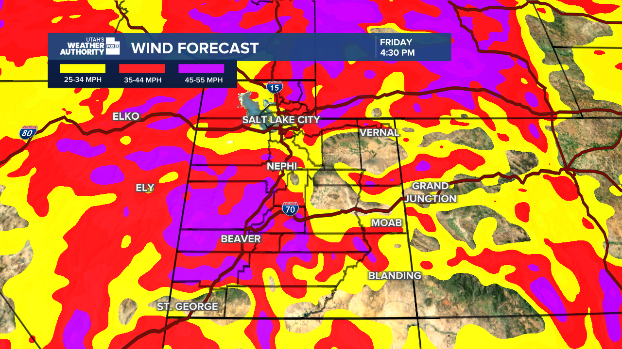
An atmospheric river will bring rain, wind, and snow across the area over the next few days. The strongest winds will be across much of Western Utah as well as Salt Lake & Tooele valleys today.

Since the winds are out of the south, it'll be warm enough for rain in most valleys. Heavy snow is likely above 8,000 feet.
After a break on Saturday, widespread rain & snow is expected again Sunday.
SALT LAKE CITY
Friday: Rainy & windy along with a slight chance of thunderstorms in the afternoon & evening. South winds 20-30 mph with gusts up to 55 mph. Highs: Near 50.
Friday Night: Rain showers in the evening, then a chance of rain & snow after midnight with little or no accumulation. Decreasing winds overnight. Lows: Near 30.
Saturday: Becoming mostly sunny after morning flurries. Highs: Mid 40s.
Sunday: Rain & snow in the morning, then rain showers through the afternoon. Highs: Upper 40s.
ST. GEORGE
Friday: Rain likely. Highs: Mid 50s.
Friday Night: Rain most likely in the evening, then showers
after midnight. Lows: Near 50.
Saturday: Partly cloudy with showers and a slight chance of PM t-storms. Highs: Low 60s.
Sunday: Partly cloudy. Highs: Mid 60s.
