

Don't leave the window rolled down on the car!
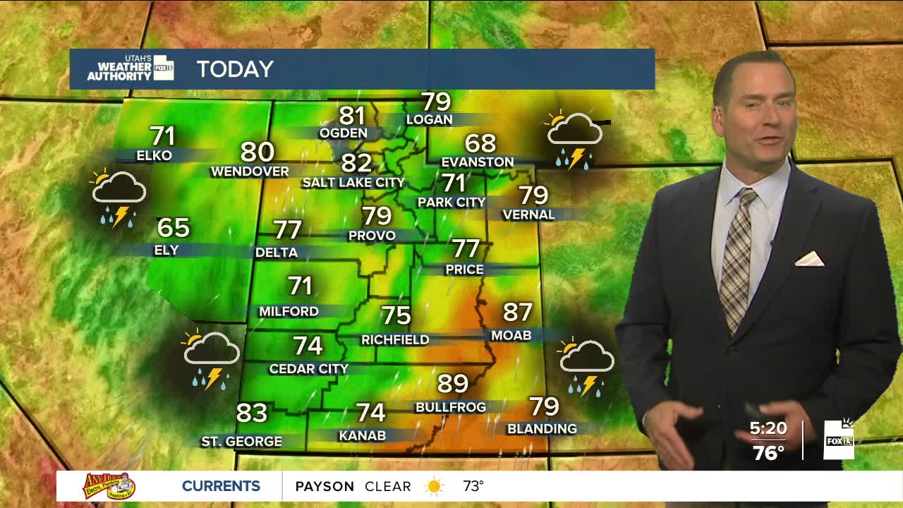
The surge of monsoonal moisture will peak today. A weather system drifting north across the state will bring widespread showers & t-storms. These will mainly be across the south in the morning, then over central & northern Utah in the afternoon & evening. Storms could linger across the north overnight. Any storms could bring heavy rain, keeping the flash flood potential high and potentially making for a slow commute this evening!
Dry air will start to move into southern Utah tomorrow then drift north over the next few days. Showers & t-storms fill still pop up over the next few days, but a gradual warming & drying trend is expected heading into the weekend.
SALT LAKE CITY
Tuesday: Mostly cloudy & cooler with a chance of showers & t-storms in the morning, but they're most likely in the afternoon & evening. Heavy rain is possible. Highs: Low 80s.
Tuesday Night: Rain showers likely with a chance of t-storms. Lows: Mid 60s.
ST. GEORGE
Tuesday: Cloudy & cooler. Showers & t-storms are most likely in the morning, then will likely decrease in the afternoon & evening. Highs: Low to Mid 80s.
Tuesday Night: Mostly cloudy with a chance of showers & slight chance of t-storms. Lows: Near 70.
