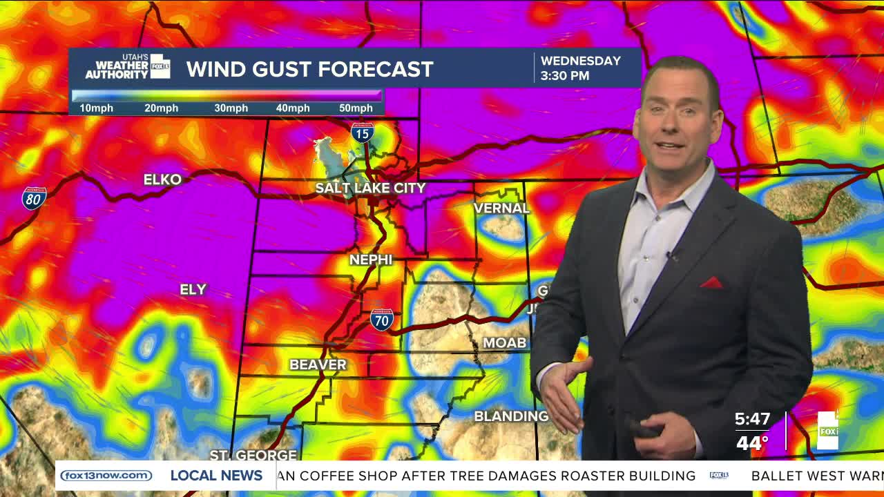

A combination of a cold front and an atmospheric river will bring wet, windy conditions across northern Utah on Wednesday, with the most active weather occurring from late morning into the mid-afternoon before quieting down in the evening.
Winds will increase and become strongest from late morning through mid-afternoon. Wind Advisories will go into effect across much of the north, with very strong gusts possibly impacting travel, especially over the mountains and southwest Wyoming.
Power outages will be possible throughout the day with the winds likely making a bigger impact than any precipitation.
Valley rain and mountain snow showers are in the forecast for the morning, but just like the wind, any show will likely be seen only between the late morning and late afternoon. Snow levels will start very high and then drop to near 5,000-6,000 feet by sunset.
The precipitation will taper off as snow levels drop, so any measurable snow in the valleys is unlikely, and most snow is still expected to be above 6,000 feet.
As for traffic conditions, slushy roads are likely along the highest passes and the Wasatch Back.
There will be a break tonight and much of Thursday before a similar storm with even more moisture will bring more valley rain and mountain snow and gusty winds on Friday and into Saturday.
SALT LAKE CITY
Wednesday: Rain likely along with isolated t-storms from late morning through sunset. SW winds 20-30 mph, possibly gusting higher in the afternoon. Winds & rain decrease by early evening. Highs: Upper 50s.
Wednesday Night: Much cooler by this evening with showers tapering off. Becoming partly cloudy after midnight. Lows: Near 30.
ST. GEORGE
Wednesday: Sunny. Highs: Mid 60s.
Wednesday Night: Mostly clear. Lows: Upper 30s.
