

A cold storm is on our doorstep!
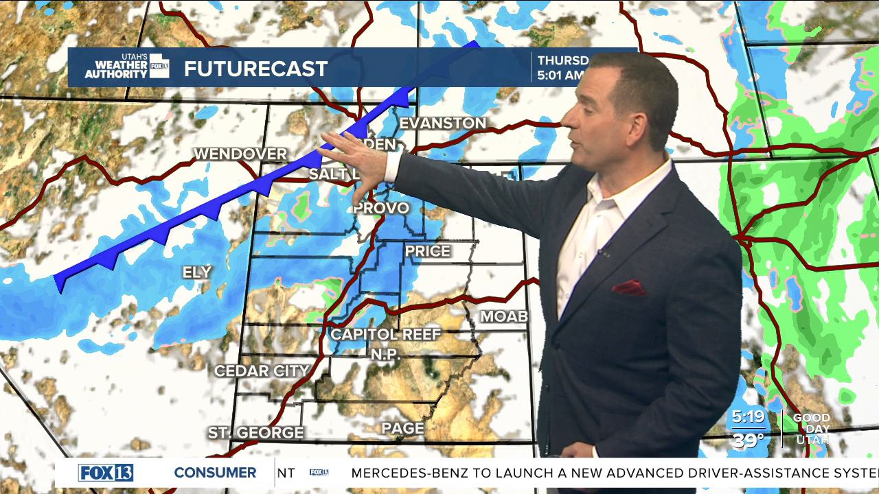
Clouds will increase and temps will be mild today ahead of a cold storm approaching from the northwest. Valley rain & mountain snow will develop across northern Utah this afternoon & evening. So, you might have to deal with wet roads for the drive home tonight.
The coldest air so far this season will move in behind a cold front early tomorrow. Rain will change to snow in the valleys early and likely have a big impact on the morning commute. Be prepared for slushy/or snow covered roads in the valleys with snow in the canyons & mountain passes.
The heaviest snow will be along the cold front in the north in the morning, then across southern Utah in the afternoon & evening.
As of now, it looks like this is how much snow we might get by 11 pm Thursday:
Northern Mtns: 6-12"
Cottonwoods / Bear River Range: 10-20"
Central & Southern Mtn: 4-8"
Valleys: 1-4"
Benches: 3-6"
Even more might pile up across parts of Salt Lake & Tooele valleys if lake effect develops.
Most snow will taper off early Friday. Behind the storm, it's going to be cold & dry this weekend with strong valley inversions possible.
SALT LAKE CITY
Wednesday: Partly cloudy in the morning, then becoming mostly cloudy with rain likely in the afternoon. Highs: Mid 40s.
Wednesday Night: Rain will mix with snow in the evening, then change to snow by morning. Lows: Near 30.
Thursday: Much colder. Snow most likely in the morning , then tapering off in the afternoon & evening. Lake effect possible. Highs: Mid 30s.
ST. GEORGE
Wednesday: Partly cloudy. High: Low 50s.
Wednesday Night: Becoming mostly cloudy. Lows: Upper 30s.
Thursday: Rain likely with a slight chance of t-storms. Snow may mix with rain at times. Highs: Mid 40s.
