


SALT LAKE CITY — You may have almost forgotten that it's still winter after unusually high temperatures and sunny skies over the last several days but a storm is creeping into Utah, bringing back wintery conditions.
Ahead of the storm, Utah saw spring-like weather, with the National Weather Service recording a high temperature of 62 degrees at the Salt Lake City International Airport on Wednesday. It marked the first 60-degree temperature recorded in January in more than two decades.
Yesterday's 62° high temperature at Salt Lake International Airport was only 1° shy of the all-time Jan high temperature, and the first 60° temperature recorded in Jan in 21 years. The temperature had reached 60° only 7 other days in Jan. Records began in 1874. #utwx
— NWS Salt Lake City (@NWSSaltLakeCity) February 1, 2024
The storm got off to a slow start on Thursday and began in southern areas of the state before moving into northern Utah later in the day.
Valleys saw mainly rain waking up on Friday, while mountains will get the bulk of the snow.
Early Friday morning, Alta and Snowbird reported five inches of fresh powder, while Eagle Point Resort in Beaver scored six inches of snow.

Winter storm warnings were issued in the southern mountains of Utah from 8 a.m. Thursday until 5 a.m. Saturday. Additional advisories were issued for the Wasatch Mountains, Bryce Canyon Country and other mountain areas.
While temperatures are cooler Friday, they're still above average for February, however, a cold front will bring frigid air on Friday night into Saturday with a rain and snow mix in the valleys. Don't get your hopes up though, even though snow is possible on the valley floors, any accumulation will be very light.
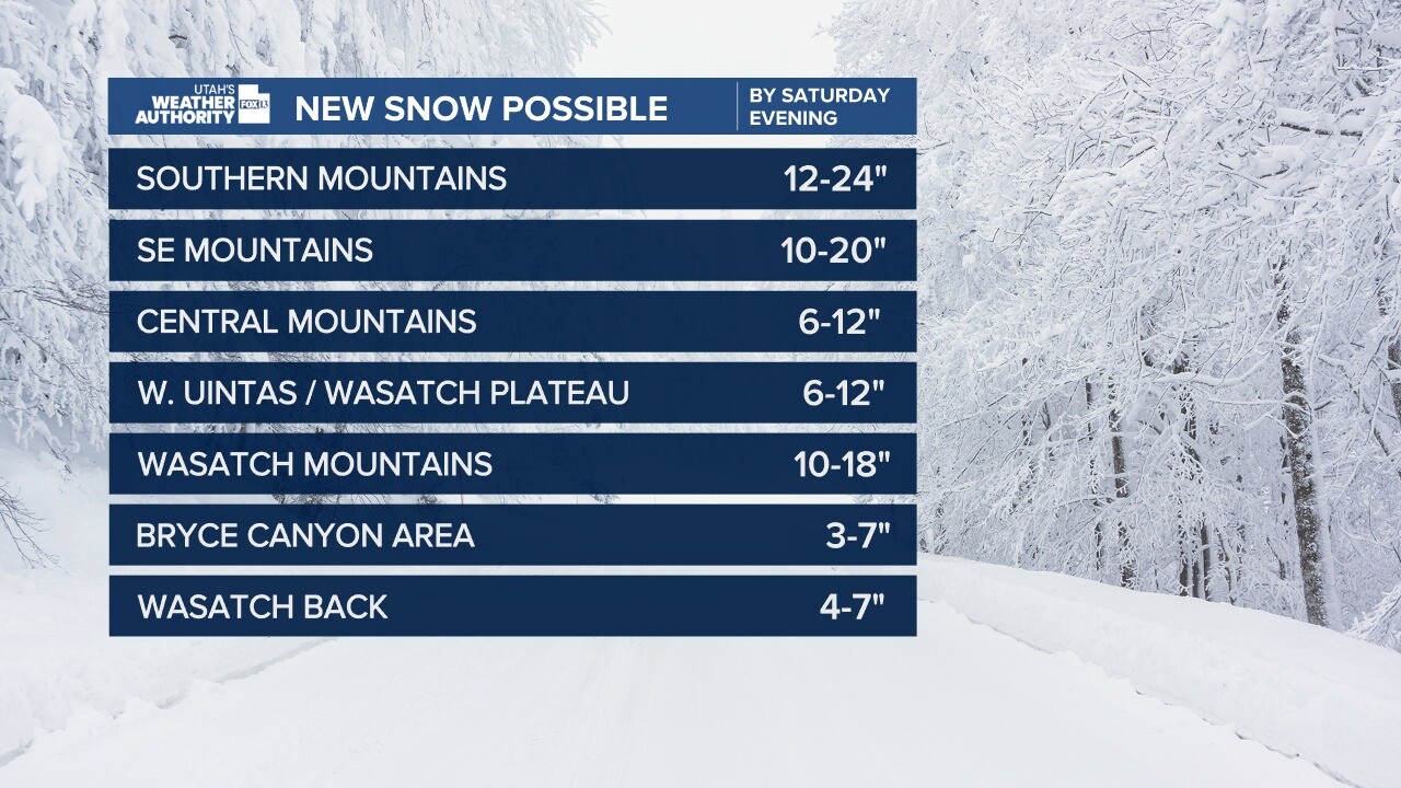
By Saturday night southern mountains could receive one to two feet of snow. It looks like central and southern Utah will get the bulk of this storm, with the Wasatch Mountains projected to get about ten to 18 inches of fresh powder.
The Utah Avalanche Center issued an avalanche watch ahead of the storm as they anticipate "dangerous avalanche conditions for southwest Utah."
"Expected heavy snowfall coupled with very weak existing snow could produce dangerous avalanche conditions," the warning reads. "Friday and Saturday are the most likely days or avalanches."
Avalanche Watch has been Issued on 02/01/2024. We are anticipating dangerous avalanche conditions for Southwest Utah. Please help us spread the message to everyone.
— UtahAvalancheCenter (@UACwasatch) February 1, 2024
Visit https://t.co/xRuSiGCnQf for more information, and be sure to Get the Forecast. pic.twitter.com/Mt1YvegGVA
On Saturday night, the storm moves on, but more wintery weather is right around the corner through next week. Utah will get a little break on Sunday with sunny and cool weather before the next storm moves in on Monday with valley rain and heavy mountain snow.
