

SALT LAKE CITY — Geologists have released a four-year study showing detailed mapping of faults along the Wasatch Front and how large earthquakes could rupture the surface, causing major damage.
“The goal of the study was to characterize the Wasatch Fault zone in sort of an unprecedented manner than we’ve ever seen before," said Emily Kleber, a hazards geologist with Utah Geological Survey. “A big exciting part of this study is that we’re able to see more of the lengths of the fault ruptures from the geologic past, especially in these urban areas.”
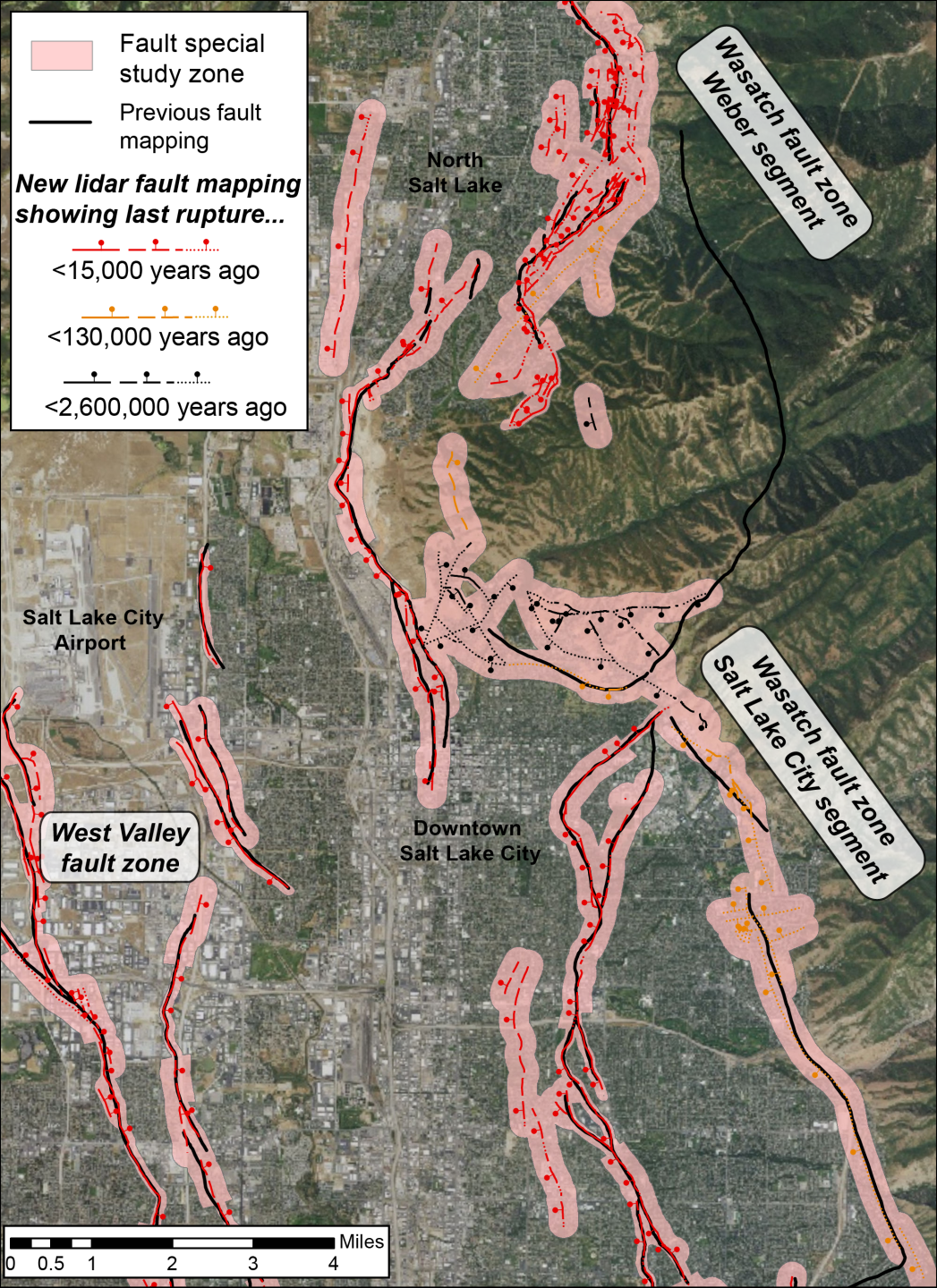
Researchers used LIDAR (Light Detection and Ranging) to map high-resolution images of roughly 210 miles along the Wasatch Front. The fault mapping and representation of 'special survey zones' indicate which areas are most at-risk to surface rupture in the event of an earthquake at 6.5 magnitude or greater.
"It’s just good to have better mapping for the fault to help planners and developers know where the traces are,” said Adam Hiscock, a hazards geologist with Utah Geological Survey. “Basically cities and counties will now use this data to help them write stronger and better geologic hazard ordinances.”
The study showed new fault traces and potential sites for future investigations of faults along the Wasatch Front. In the study, the fault length went unchanged, however 288 miles of new fault traces were mapped.
“Fault zones are complicated. They are wide, they change along the whole range front," said Kleber. More information regarding the study will be released at a later date outlining specific hazards.
UGS members hope to have study information regarding the Magna earthquake available later this year as well.

“I’ve lived in Utah my whole life but never felt and earthquake here in Utah so just feeling a small-ish earthquake like that was really eye opening for a lot of people and myself included even though I study earthquakes," said Hiscock.
At 5.7 magnitude, the Magna incident wasn't particularly useful in the four-year study due to the criteria. Ruptured surface or areas of investigation are primarily focused on larger earthquakes.
