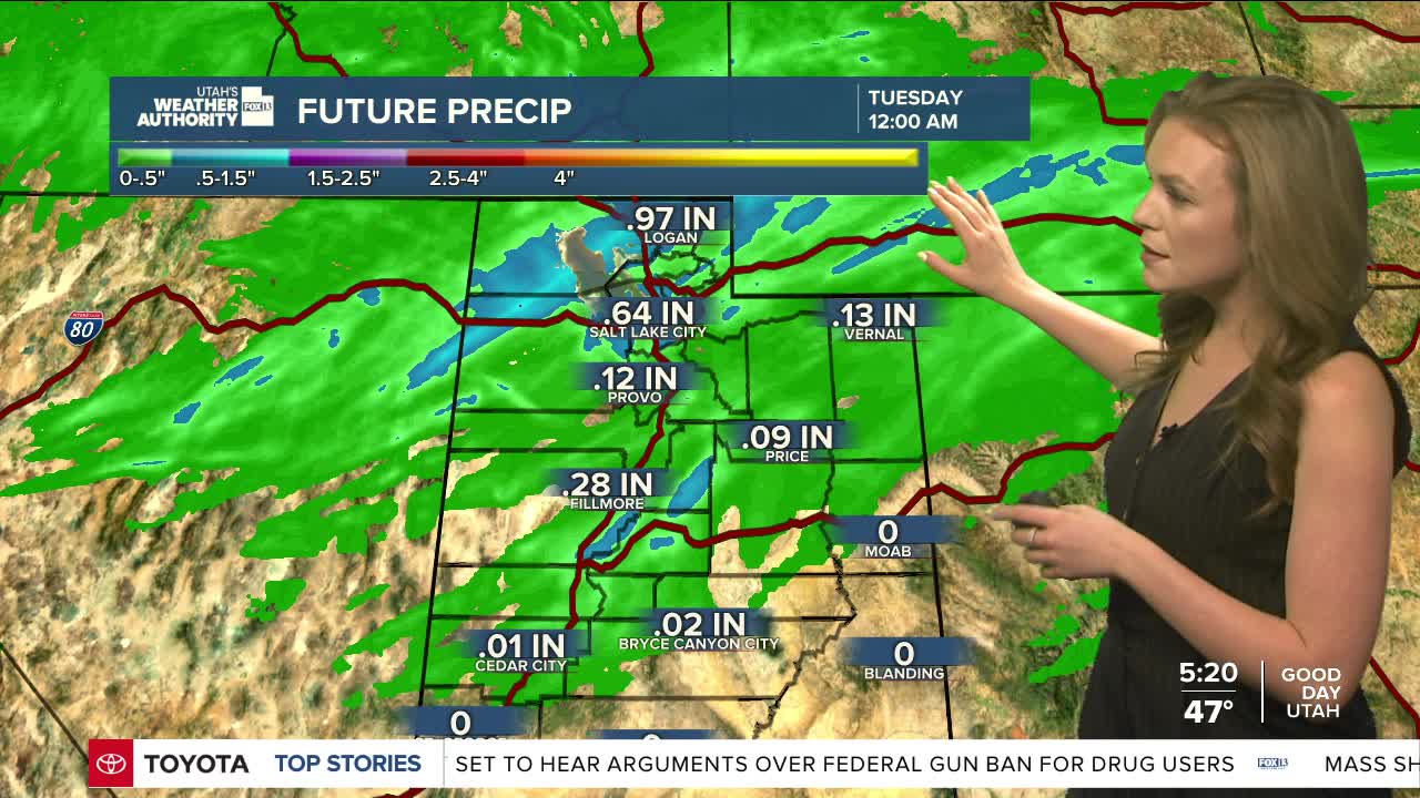


A cold front moving through the region on Monday will spread valley rain and mountain snow across much of northern Utah and parts of southwest Wyoming.
Snow will fall at levels expected to start around 9,000 feet but could drop to about 7,000 feet by late afternoon. Higher elevations could see some snow accumulation before showers taper off Tuesday morning.
After a brief break in the weather late Tuesday into early Wednesday, another storm is expected to arrive Wednesday night and continue into Thursday. This system will be colder and may bring heavier mountain snow. There is also a small chance that snow could reach some valleys in northern Utah.
Temperatures are set to return to near normal for early March after the storm. Another round of unsettled weather is possible over the weekend, but confidence is still low.
