

SALT LAKE CITY — Most of central and southern Utah are in store for additional wintry conditions Tuesday as advisories and warnings have been issued for large portions of the state.
LIVE RADAR - Track the storm with FOX 13s up-to-the-minute interactive radar
The National Weather Service says Tuesday's storm will bring "widespread moderate to heavy snow accumulations" and categorized the system as a major weather risk.
WEATHER ALERTS - Check out latest alerts for Utah
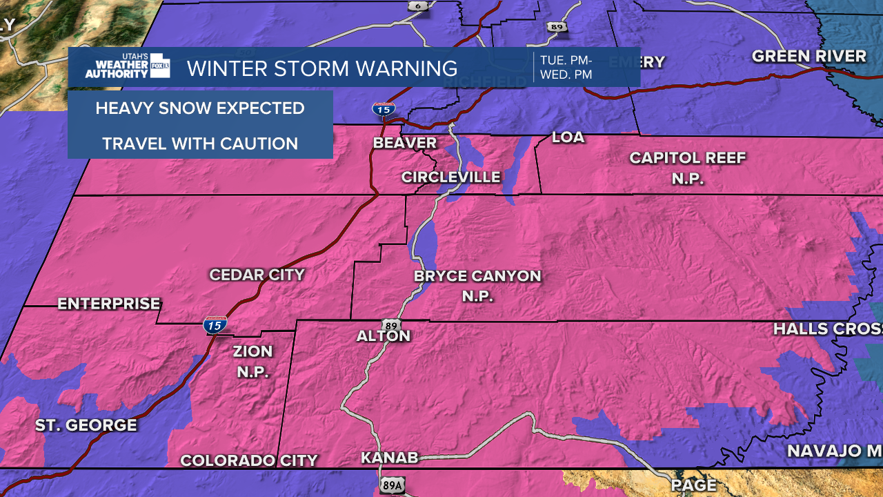
A Winter Storm Warning has been issued for the southern part of Utah ranging from Milford down to the Arizona border, while an Advisory is in place from around Nephi south to Milford.
Snow accumulations up to eight inches are possible for southwest Utah, as well as Zion, Bryce Canyon and Capital Reef national parks and surrounding areas. Other areas under advisories can see as much as five inches of snow in some locations.
FREE DOWNLOAD - Utah's Weather Authority app has all the storm information you need
Drivers should expect winter conditions along the following areas:
- US-89 through all of central and southern Utah to the Arizona state line
- I-15 through Black Ridge Canyon
- SR-24
- I-70 to Green River
Areas in the Wasatch Mountains and Salt Lake Valley were recipients of a healthy snow totals Monday, with Snowbird receiving five inches.
In addition to the snow, the NWS forecasts heavy winds up to 50 mph Tuesday night through Wednesday along the northern Wasatch Front in Farmington, Weber and Ogden canyons.

