

SALT LAKE CITY — A storm system that is expected to dump much-needed snow across large parts of Utah is forecast to arrive Thursday.
LIVE RADAR: Following the snowstorm as it nears your neighborhood with FOX 13s interactive radar
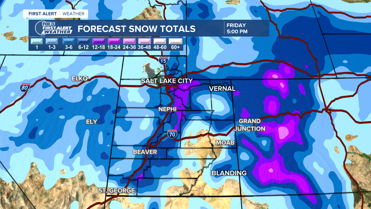
The FOX 13 weather team has laid out a timeline of what to expect throughout Thursday and into the weekend.
THURSDAY:
- MIDNIGHT - Rain along the Wasatch Front to begin, along with snow falling in the northern Utah mountains.
- 5:00 AM - Rain starts to turn to snow in far northern Utah.
- 8:00 AM - All snow, no rain on the Wasatch Front during the morning commute, creating dangerous driving conditions.
- 6:00 PM - System pushes through towards central and southern Utah.
FRIDAY:
- 9:00 AM - Possibility exists for lake effect snow to return Friday morning from Centerville to Draper.
The mountains south of Interstate 80 are forecast to see up to 24 inches of snow, while mountains north of the highway could be hit with a foot of snow during the storm.
Most valleys around the state are expected to receive up to a 6 inches, although Cache Valley and the eastern valleys will see less snow.
DOWNLOAD FREE - Get updated information on the FREE FOX 13 weather app
Along with the snowfall, temperatures around northern Utah will drop significantly, with lows in the high teens Friday night.
