
A nice and cool start to Sunday morning along Northern Utah as a slow-moving cold front continues to push through the state. The cold front has helped drop temperatures 10-15 degrees below normal over northern Utah while keeping fire weather concerns elevated across the south.

High temperatures across northern Utah will struggle to reach the mid to upper 60s this afternoon—roughly 20 degrees cooler than normal for this time of year. The cooler air will also bring the chance for a few light showers across northern Utah through early Monday, though rainfall amounts are expected to remain light.
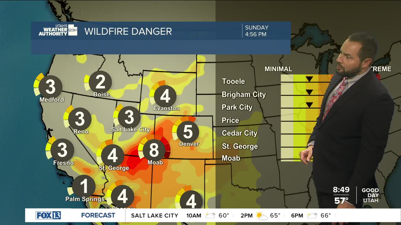
Meanwhile, southeastern Utah will continue to deal with strong southwest winds and very dry conditions. Red Flag Warnings remain in effect through the evening as gusty winds and low humidity create critical fire weather conditions.

The cooler weather won't last long. Temperatures will begin climbing again Monday, with a steady warming trend through the week. By next weekend, much of Utah will once again be dealing with hot, dry summer weather.
