

A cold, wet start to the week!
The brunt of the latest storm hit to the north of us, but valley rain & mountain snow was widespread across Northern Utah last night & early this morning. Snow levels dropped to about 6,000 ft. with most accumulation above 8,000 ft. Winter driving conditions are expected this morning over some of the higher passes like Logan Canyon and Monte Cristo east of Ogden.
Rain showers should taper off in the morning as the storm pulls away, while snow could linger in the mountains into the afternoon.
Cold air in place behind the storm will make it feel like winter tomorrow morning. Near or below freezing temps and patchy frost are expected in many northern valleys. Freeze alerts will go into effect in the Eastern Uinta Basin as well as near Capitol Reef.
High pressure building in tomorrow will usher in a warming trend for the rest of the week.
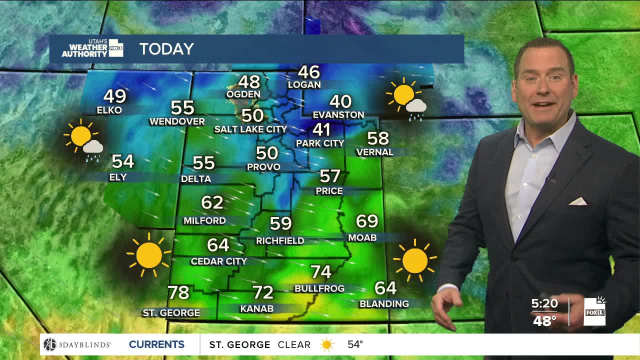
SALT LAKE CITY
Monday: Showers are expected to taper off by mid to late morning, then becoming mostly sunny by afternoon. Highs: Near 50.
Monday Night: Mostly clear & colder. Lows: Near 30.
ST. GEORGE
Monday: Sunny. Highs: near 80.
Monday Night: Mostly clear. Lows: Mid 40s.
