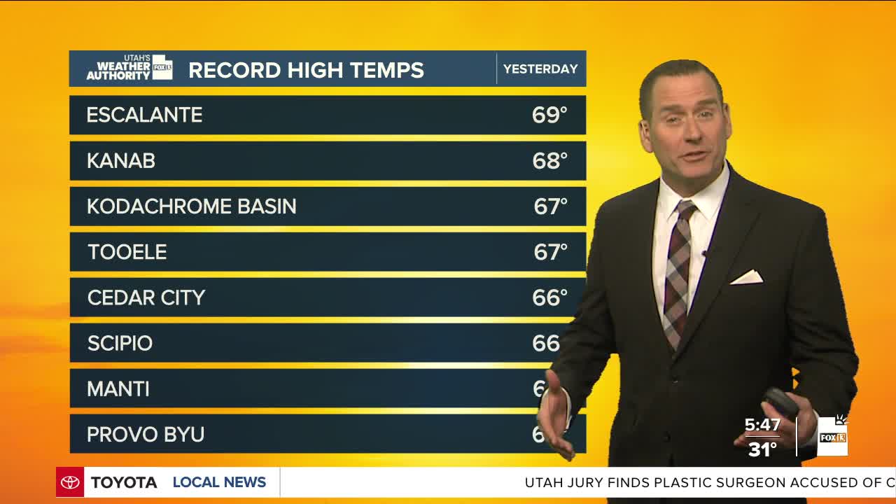

Cold air spilled in behind yesterday's storm, so it finally felt like the holidays this morning! After record temps on Wednesday, it's going to be noticeably cooler Thursday, but still well above average.
Utah is between storms, but there's a chance of light mountain snow and a light rain/snow shower in northern valleys during the day, mainly north of Interstate 80 and east of Interstate 15.
An atmospheric river enters the Pacific Northwest today and will sag south into Utah on Friday. Winds will increase ahead of the storm, although likely not as strongly as on Wednesday.
The west-southwest winds will also help temperatures climb even higher.
There could be high elevation mountain snow, but very little below 7,000 feet, and just rain in the valleys once again.
More moisture is forecast to move in at the end of the weekend; however, the bulk of the precipitation will likely be north of Utah.
SALT LAKE CITY
Thursday: Mostly cloudy & cooler with a 30% chance of rain & snow showers in the early afternoon. Highs: Near 50.
Thursday Night: Mostly cloudy. Lows: Near 40.
ST. GEORGE
Thursday: Sunny. Highs: Low 60s.
Thursday Night: Mostly clear. Lows: Near 40.
