DUCHESNE COUNTY, Utah — A tornado touched down in eastern Utah on Sunday, according to the National Weather Service.
In a report released Tuesday, the NWS of Salt Lake City said the tornado hit an area of Indian Canyon in Duchesne County — near the summit of U.S. Highway 191 and Argyle Canyon Road — around 9:15 a.m. It was on the ground for about four minutes and traveled two miles in that time.
Although the NWS said it was in a "remote" area, the tornado did appear to cross the highway.

The twister was given a strength rating of EF-2, which is on the 0-5 "Enhanced Fujita Scale." It measures tornadoes based on wind speed, while the F-scale measures them based on damage. A 2 or 3 on the EF scale is considered "strong." Ratings of 0-2 are categorized as "weak," and 4-5 are "violent."
Its peak wind speed of the tornado was 125 miles per hour, according to the NWS. Its maximum width was 880 yards.
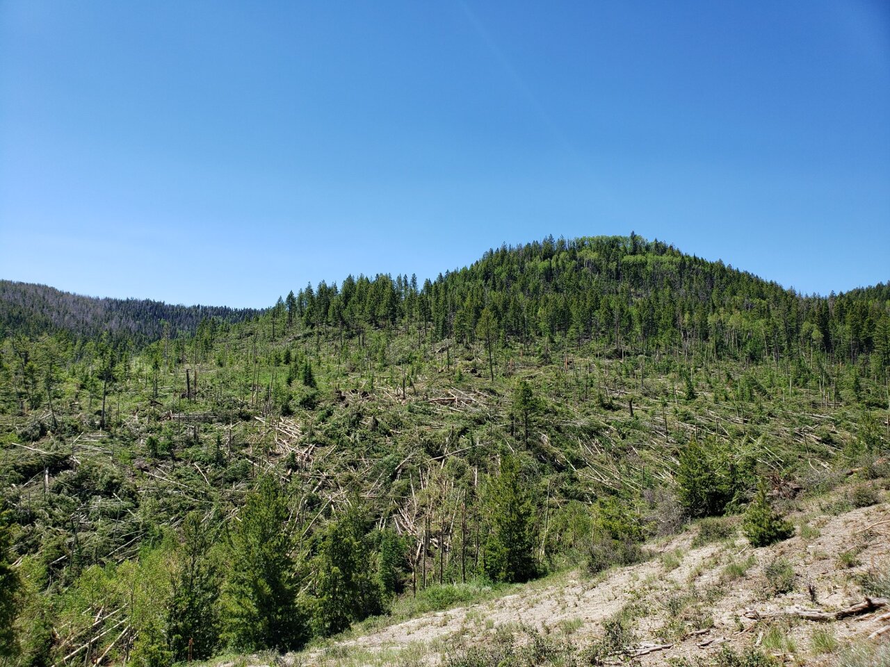
There were no injuries or deaths, but it did leave a path of destruction in the forest.
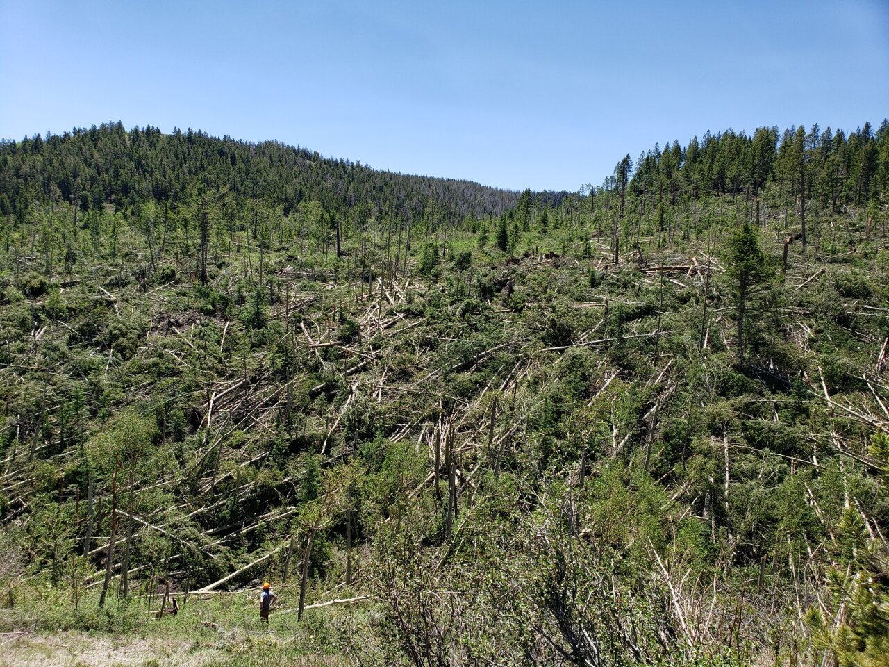
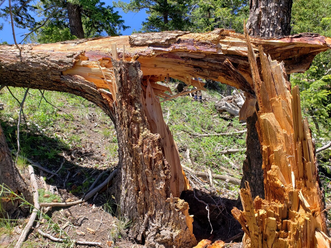
"Almost all trees over a large hillside facing the road were violently blown down, snapped, or topped into a clearly convergent axis," the NWS wrote about the area where the worst damage was observed. "Several tree tops were deposited along the creek and road with no clear indication as to where they originated."
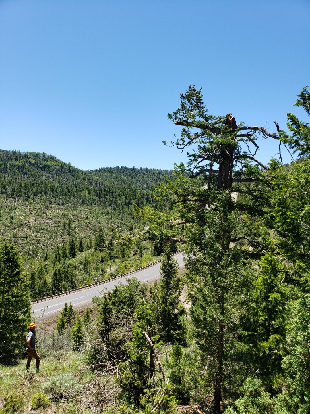
The full summary reads:
"A tornado developed near the summit of US-191 and Argyle Canyon Road in remote southwestern Duchesne County at about 9200 feet. Sporadic damage is noted in this area as it moved north over a ridge line and into a valley adjacent to US-191 along Indian Canyon.
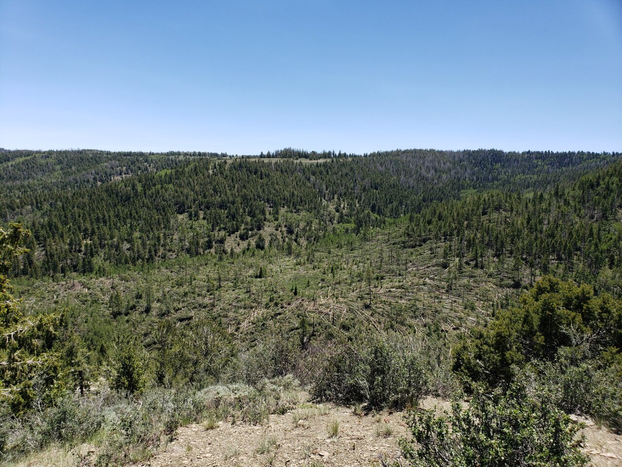
"The tornado then descended down the length of the valley from about 9200 feet to a creek adjacent to US-191 at an elevation of about 8500 feet. Over this period, both the strength and and width of the tornado increased substantially with a continuous damage path through a mixed aspen and conifer forest. The maximum damage was found in this area and was significant. Almost all trees over a large hillside facing the road were violently blown down, snapped, or topped into a clearly convergent axis. Several tree tops were deposited along the creek and road with no clear indication as to where they originated.
"The tornado then crossed US-191 and ascended the hillside from about 8500 feet to another ridge on the northwest side of the road to an elevation of about 9100 feet. Considerable damage was noted immediately north of US-191 where numerous trees were snapped or uprooted, although not to the severe extent noted on the south side of the road. Damage decreased considerably up the hillside to the top of the 9100 foot ridge line with more sporadic toppled trees.
"A few toppled trees were noted into the next basin over the ridge on the north side of the road, marking the last discernible damage from the tornado, and the end of the 2 mile damage path."