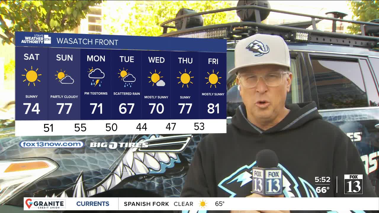


The first day of May is looking good...and even better this weekend!
Canyon winds along the Northern Wasatch Front will decrease after sunrise. Otherwise, it's going to be a sunny & mild spring day!
High pressure building over Utah will keep it dry & help temps climb about 10 degrees above average this weekend. It'll warm up into the mid to upper 70s along the Wasatch Front and into the mid 80s in Lower Washington County.
A storm approaching from the southwest will allow moisture to move into Southern Utah by Sunday afternoon & evening, bringing a chance of showers & t-storms. Wet weather will develop over Northern Utah by Monday morning with valley rain & high elevation mountain snow lingering through midweek. It's not going to be a cold storm, valley temps will still hover near normal.
It will dry out and warm up even more by the second half of next week.
SALT LAKE CITY
Friday: Sunny & slightly warmer. Highs: Upper 60s.
Friday Night: Mostly clear. Lows: Mid 40s.
Saturday: Sunny. Highs: Mid 70s.
Sunday: Partly cloudy. Highs: Upper 70s.
ST. GEORGE
Friday: Sunny. Highs: Near 80.
Friday Night: Mostly clear. Lows: Lower 50s.
Saturday: Sunny. Highs: Mid 80s.
Sunday: Partly cloudy with a chance of showers & t-storms in the evening. Highs: Upper 80s.
