

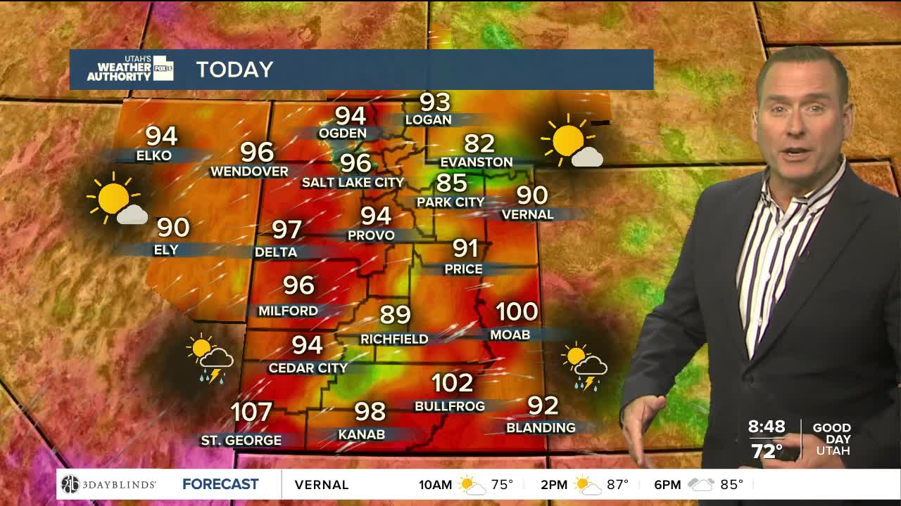


Some hot weather to get over the mid-week hump! Temps will climb several degrees above average along the Wasatch Front and well above the century mark in far Southern Utah, where the heat risk will be high.
Showers & thunderstorms will pop up again this afternoon & evening, mainly along and over the higher terrain. Today will likely be the least active weather day this week, before storms increase on Thursday & Friday.
Monsoonal moisture will bring widespread wet weather this weekend with some storms capable of producing heavy rain and leading to flash flooding. A cold front will move through on Saturday, knocking temperatures down about 5-10 degrees and bringing a break from the late summer heat.
SALT LAKE CITY
Wednesday: Mostly sunny & warmer. Highs: Mid 90s.
Wednesday Night: Partly cloudy. Lows: Near 70.
ST. GEORGE
Wednesday: Sunny & very hot! Highs: Near 107.
Wednesday Night: Partly cloudy. Lows: Upper 70s.