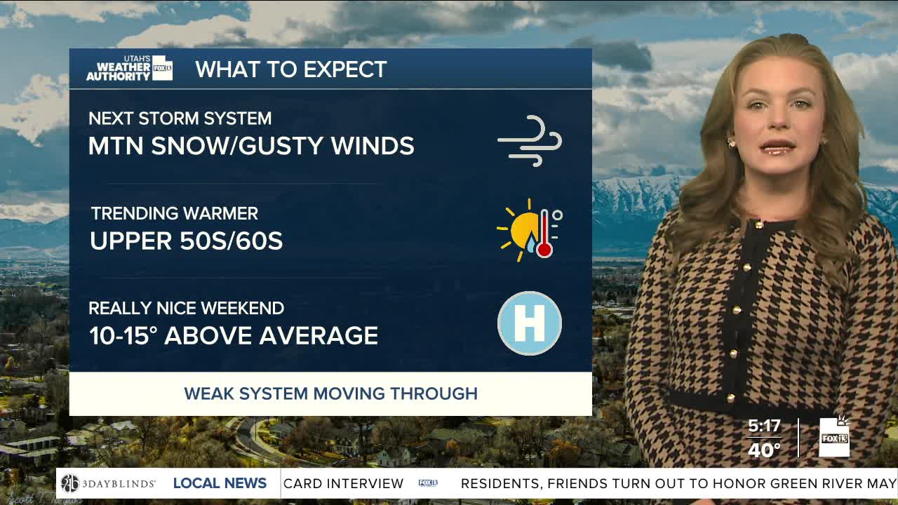


While the heaviest precipitation will stay north, parts of southwest Wyoming and far northern Utah will see gusty winds and light mountain snow Tuesday and Wednesday. Snow levels in northern Utah will stay near 7,000 feet on Tuesday and rise to around 9,000 feet Wednesday. Significant snow accumulation is unlikely.
The Bear River Range could get up to 0.4 inches of water, with lighter amounts in the Wasatch and Uinta mountains. Strong winds with gusts up to 50 mph will blow across southwest Wyoming and parts of northeast Utah through Wednesday.
On Thursday, high pressure will bring dry and warmer conditions which will send daytime highs 10 to 15 degrees warmer than average for through weekend.
While model confidence is low, next best chance for a storm will be on Tuesday.
