

Warm & windy today!
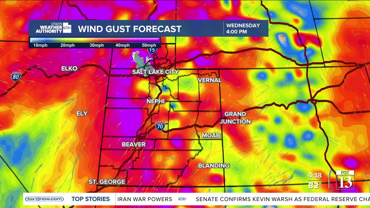
Widespread southwest winds could gust up to 25 to 40 mph across much of the area today and even up to 60 in some spots! That will help temps climb about 10 to 20 degrees above average. Records are possible, but not as likely as the last couple days.
There's a risk of severe thunderstorms for the afternoon across northern Utah. These storms can produce gusty winds of up to 60 mph, and the possibility of small hail.
In fact, there are Severe Thunderstorm Warnings from the National Weather Service in effect for several counties across the state.
The gusty winds will also create areas of blowing dust.
The combination of hot, dry, windy weather will lead to increasing fire danger with a Red Flag Warning in effect across SW Utah.
The winds are ahead of a cold front that will slide across Northern Utah this evening and then south across the state later tonight. Strong NW winds are expected for a few hours behind the front in NW Utah this evening.
Temps will be much cooler tomorrow, but still close to average for this time of year.
SALT LAKE CITY
Wednesday: Partly cloudy & breezy with a slight chance of t-storms in the afternoon & early evening. Storms could produce strong gusty winds! Highs: Near 90.
Wednesday Night: Slight chance of t-storms with areas of blowing dust possible. Mostly clear overnight. Lows: Lower 50s.
Thursday: Sunny & cooler. Highs: Low 70s.
ST. GEORGE
Wednesday: Becoming mostly sunny. SW winds 10-20 mph in the afternoon. Highs: Mid 90s.
Wednesday Night: Mostly clear. Lows: Near 60.
Thursday: Sunny. Highs: Low 90s.
