SALT LAKE CITY — Although the calendar says it's been "spring" for two weeks, a significant winter storm landed in Utah Sunday night and is expected to last until Wednesday.
TRACK THE STORM: Get real-time storm information by downloading the FREE Utah Weather Authority app
As of 10 a.m., Ogden had already amassed 12 inches of snow since Saturday evening, while Powder Mountain measured 14 inches in the same period of time.
Ahead of the storm, some schools, including the University of Utah, called for remote learning days, closing down campus in order to keep students and staff safe.
Many Utah schools are on their scheduled spring break this week, meaning they won't need to deal with school closures as winter weather hits the state.
LATEST: Check out the latest updates about school closures across Utah
Due to the storms, dozens of flights into and out of the Salt Lake City International Airport were delayed Monday.
Airport officials said in total, 26 flights were delayed as planes work on deicing aircraft. The airfield is clear, so planes are able to safely land and take off as crews worked through the early morning hours to move snow.
The snow will pick up again Monday afternoon and last through early Wednesday for most of northern Utah. It will also hit central Utah and as far south as Cedar City.
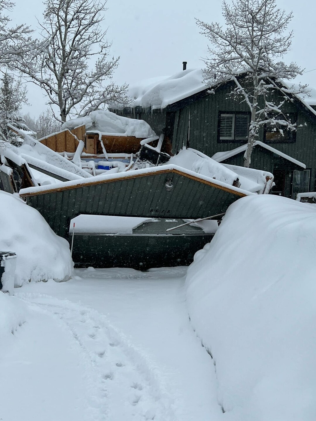
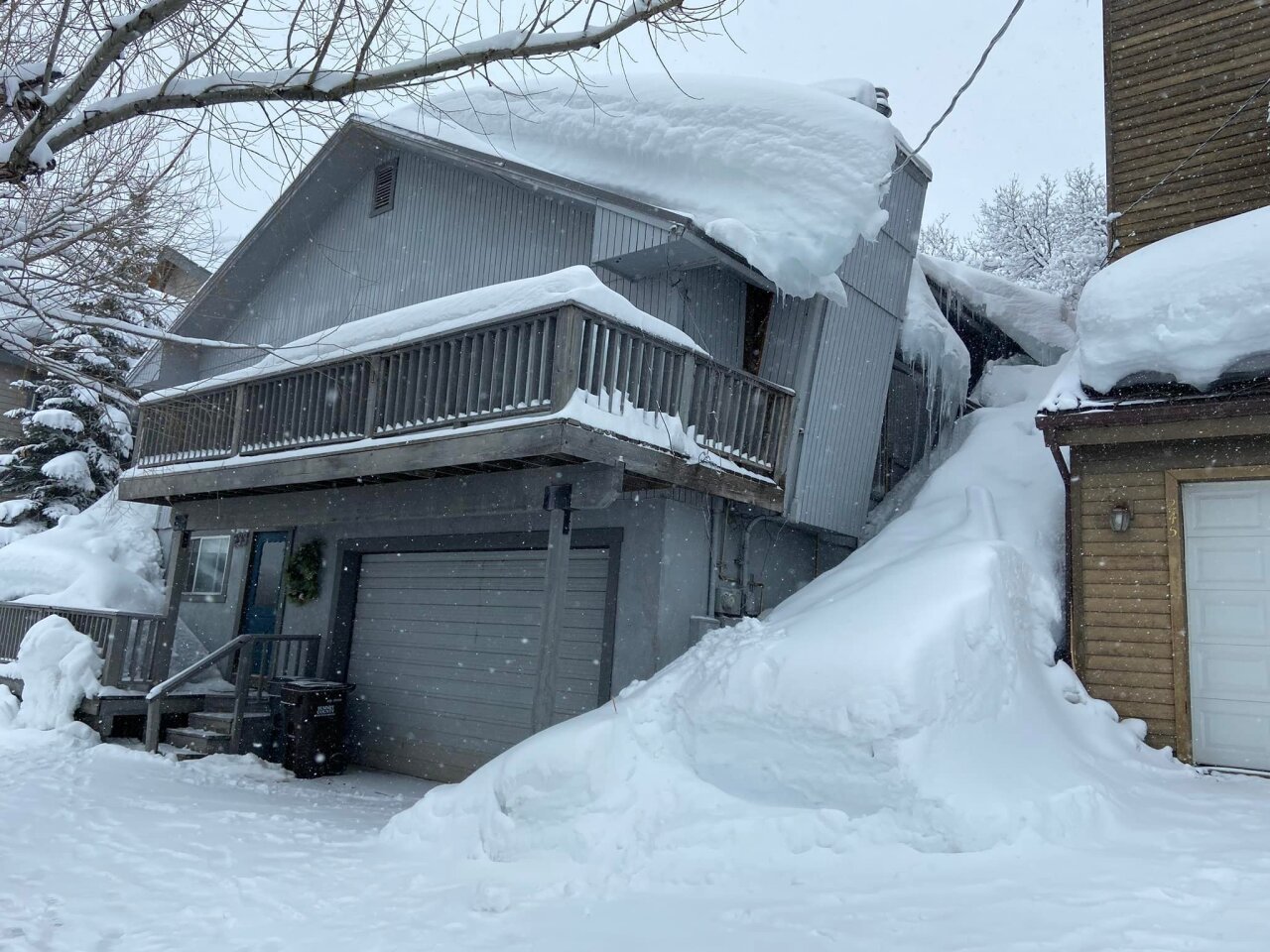
Heavy snow accumulation caused two structure collapses in Park City on Monday morning.

A garage collapsed on Gorgoza Drive, while a chimney fell on Norfolk Avenue. No one was injured in the collapses, but the fire district urged residents to be aware of roof avalanches and to clear away snow and ice.

State Route 210, which runs through Little Cottonwood Canyon, closed Sunday night for avalanche mitigation. It did not reopen at all Monday, and the Utah Department of Transportation announced Monday afternoon that it will remain closed overnight.
🚧 #RoadClosureUpdate 🚧
— UDOT Cottonwood Canyons (@UDOTcottonwoods) April 3, 2023
Due to conditions, #SR210 will not open today (4/3) and will remain closed overnight.
No ETO for tomorrow (4/4) - will update when known.@UDOTavy @UDOTRegionTwo @UtahDOT @AltaCentral @AltaAlerts @alta_of @SnowbirdAlerts @UPDSL @RideUTA pic.twitter.com/STHuaYXxiq
"Those at Snowbird today will be treated to an LCC classic country club day as conditions permit," the resort wrote in a tweet.
The town of Alta announced an interlodge order at 8 p.m.

Although mild spring temperatures could limit valley accumulation in the daytime, colder temperatures and a chance for lake effect will bring the best chance for heavy snow overnight and Tuesday night.
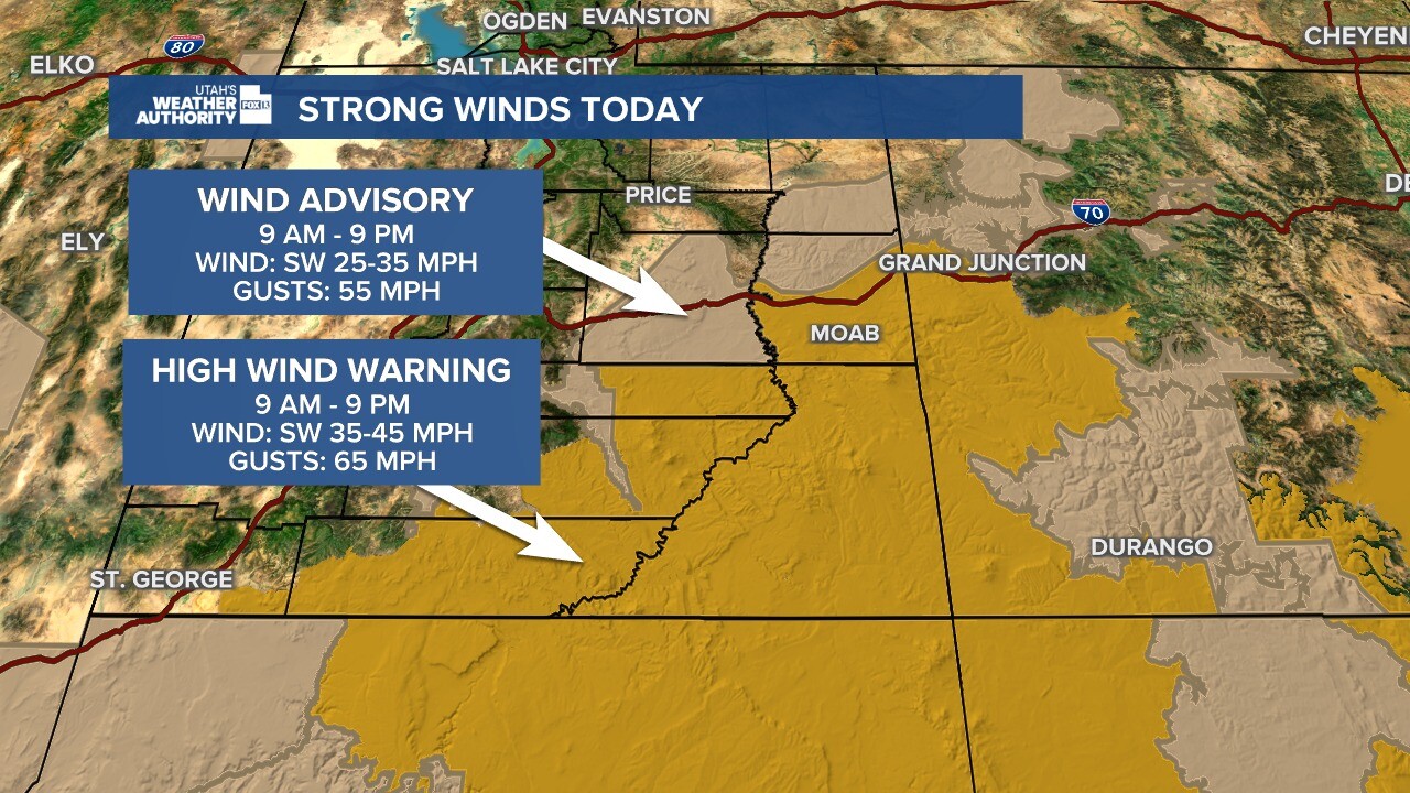
Meanwhile in southeastern Utah, High Wind Warnings are in effect until Monday evening with wind gusts of up to 70 mph possible.
Southern areas of the state will see more of a rain and snow mix without much accumulation.

Winter Storm Warnings are in effect for the majority of the state, largely centered around the I-15 corridor and stopping just shy of St. George.
❄️🧵(1/4) Our upcoming storm will be a LONG DURATION event with many aspects of the storm, but here we will break down the storm into two phases. TLDR; Phase 1: Snow totals Now-Noon Monday (left image)
— NWS Salt Lake City (@NWSSaltLakeCity) April 2, 2023
Phase 2: Snow totals Noon Monday-Midnight Wednesday (right image) #utwx #wywx pic.twitter.com/rtY2FhFMOj
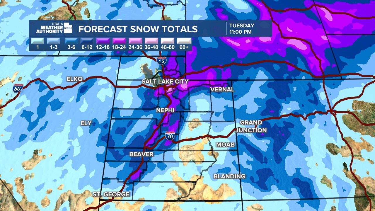
Most of the Wasatch Front from Logan to Provo is expected to get between 4-8 inches of snow by the end of the storm, but the Salt Lake area may get as much as 11 inches. Tooele Valley should get 9-14 inches, and Park City could see a whopping 18-25.
Road Weather Alert:
— UDOT Traffic (@UDOTTRAFFIC) April 2, 2023
A late season winter will push thru Utah Sun night into Mon, bringing widespread road snow.
Note: additional RWAs will be issued over the coming days as this storm continues.
For more info, visit: https://t.co/4P1gO2c9Uo#utsnow #utwx @UtahTrucking pic.twitter.com/8JlzuXYLbs
It's good news for skiers — resort areas in Utah's canyons are expected to get between 10 inches at Beaver Mountain and over two feet in Brighton. However, both Little and Big Cottonwood canyons closed overnight for avalanche mitigation.
The Utah Department of Transportation reported State Route 210 (Little Cottonwood) closed at 10 p.m. Sunday, and S.R. 190 (Big Cottonwood) closed at 12:30 a.m. Monday.
Just before 6 a.m. Monday, officials reported S.R. 190 was open after snow totals came in much lower than expected overnight. They warn that another closure this afternoon or tonight is possible based on current conditions.
"If you’re not skilled at driving in the mountains during severe winter weather, please don’t drive up," UDOT wrote in a tweet. "There are carpool, shuttle and transit options."
🚧 #RoadClosureAlert 🚧
— UDOT Cottonwood Canyons (@UDOTcottonwoods) April 3, 2023
ATTENTION: Both canyons will be closed for avalanche mitigation tomorrow morning (4/3).#SR210: closed at 10pm tonight#SR190: closed at 12:30am tonight
‼️No ETO tomorrow (4/3) for either canyon. Please plan your travels accordingly.
@UDOTRAFFIC pic.twitter.com/fcHhKTyFgd
In preparation for the storm, Rocky Mountain Power reports they are preparing for possible outages across the state and into southern Wyoming.
The combination of winds and snow may be the cause for power outages from midnight Monday into Tuesday evening and RMP says their crews are standing by, ready to respond "around the clock in restoration efforts."
As of Monday morning at 9 a.m., about 3,600 customers were without power in Utah. It's unclear if the outages were due to weather or another cause.
If your neighborhood experiences a power outage, use the RMP app to report an outage.


