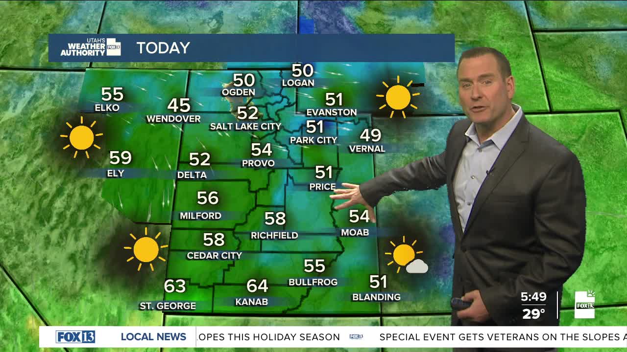


It's a mild start to the week with temps still running about 10-20 degrees above average. Valley haze will stick around with moderate air quality expected along the Wasatch Front.
A few storms finally start to move through from Tuesday night into the weekend. Besides breaking up the inversions and bringing better air quality, we'll finally get some snow up in the mountains! They're not going to be big snow-makers, but at this point we'll take what we can get.
Precipitation is most likely on Wednesday and then again Friday night into Saturday. With both storms, snow levels will start out around 8,000 ft. and then drop near 5,500-6,000 ft. So while the resorts will get some heavy, dense snow, it's just going to be rain in the valleys.
SALT LAKE CITY
Monday: Sunny. Highs: Low 50s.
Monday Night: Partly cloudy. Lows: Mid 30s.
ST. GEORGE
Monday: Sunny. Highs: Low 60s.
Monday Night: Mostly clear. Lows: Mid 30s.
