

It's the last week of winter, but in a couple days it's going to feel like early summer!
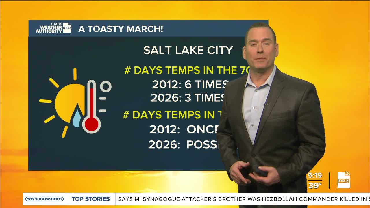
A strong ridge of high pressure building over the west will keep it dry & help temps climb higher than ever recorded in Utah during the month of March! It'll warm up near 80 along the Wasatch Front by mid-week and climb into the 90s in lower Washington County! In fact, records will likely be broken every day from Wednesday through Saturday.
The ridge will flatten out by the end of the weekend. Temps will drop slightly, but it's still expected to be warm and dry through the middle of next week.
SALT LAKE CITY
Monday: Becoming partly cloudy & warmer. Highs: Near 60.
Monday Night: Partly cloudy. Lows: Mid 40s.
ST. GEORGE
Monday: Sunny. Highs: Near 80. .
Monday Night: Mostly clear. Lows: Near 50.
