SALT LAKE CITY — A new round of Flash Flood Warnings were issued for parts of southern Utah Tuesday, although flooding was not as severe as what was seen Monday in Cedar City.
Meanwhile, the monsoonal moisture that caused the devastating floods Monday is moving north, bringing the potential for flash flooding around the Wasatch Front.
LIVE RADAR: Track storms in your Utah neighborhood

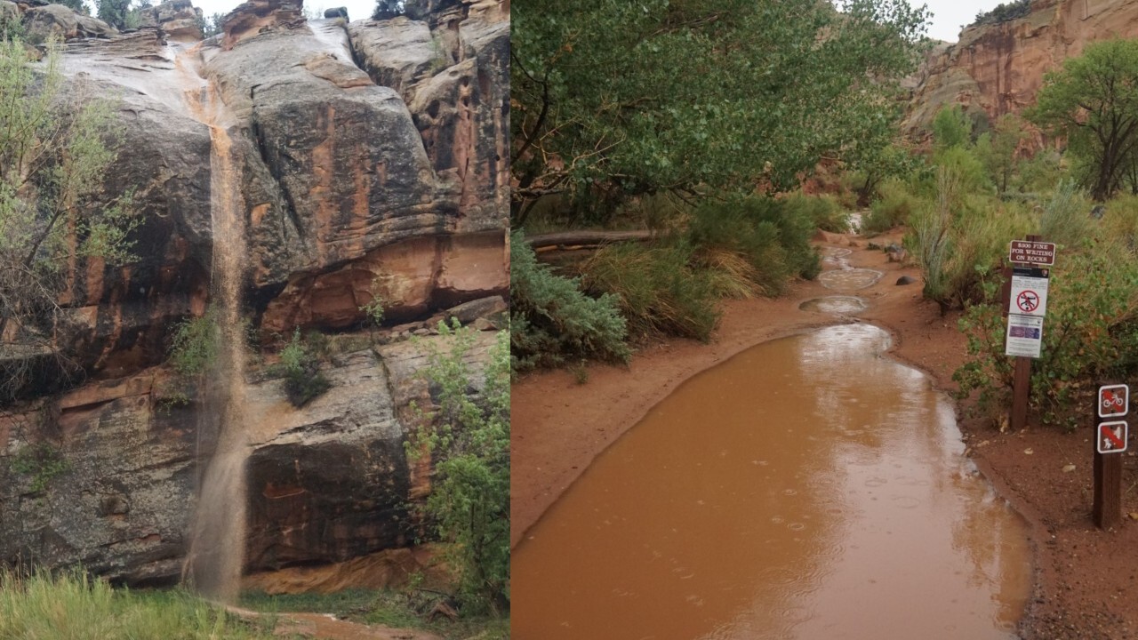
The Scenic Drive at Capitol Reef National Park is closed until further notice as the park received just over half an inch of rain Tuesday. Photos sent by park officials showed the Fremont River raging, along with flooded entrances to trails and makeshift waterfalls.
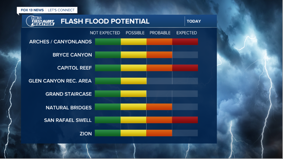
A Flash Flood Warning issued by the National Weather Service that included Garfield and Wayne counties has expired, but a separate warning in the vicinity of the same area will expire at 5 p.m.
Another warning for parts of Glen Canyon National Recreational Area in Garfield County will last until 5:45 p.m. and includes slot canyons and washes along Hole in the Rock Road outside of Escalante including: the Egypts, Peekaboo and Spooky canyons, and the upper basin of Coyote Gulch.
WATCH: Cleanup underway in Cedar City after flooding causes extensive damage
Northern Utah should brace for a 40% chance of afternoon thunderstorms that may bring heavy rain, lightning, and gusty winds. Especially concerning to the area is rain sparking flash flooding, especially around burn scars.

Cedar City was deluged with 2.15 inches of rain Monday, sending water into homes and submerging cars sitting in parking lots. A State of Emergency was declared as crews helped house those displaced by the floods.
The Millard County Sheriff's Office posted on Facebook that flash flooding closed U.S. Highway 50 near milepost 146 (near Scipio and Salina).


