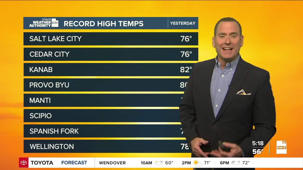


We've got one more warm day before cooler, wet weather settles in! Breezy SW winds will help temperatures climb well above average again today, although they'll likely be a few degrees lower than yesterday.
There's a slight chance a few showers could pop up this afternoon & evening, but valley rain & high elevation mountain snow will become widespread by late tomorrow as the first of two storms moves through.
After a quick break mid-week, a stronger, colder storm will mainly bring precipitation the northern half of the area on Thursday & Friday. It could be cold enough for snow to mix with rain in the valleys and possibly even change over entirely to snow on Friday morning. Any accumulation would be light.
Both storms will bring much needed snow to the mountains with significant accumulations possible! Keep your fingers crossed!
SALT LAKE CITY
Monday: Partly cloudy with a 20 percent chance of showers in the afternoon. Highs: Mid 70s.
Monday Night: Mostly cloudy with a slight chance of showers. Lows: Near 50.
ST. GEORGE
Monday: Sunny in the morning, then becoming partly cloudy. Highs: Low 80s.
Monday Night: Partly cloudy & breezy. SW winds 10-20 mph in the evening. Lows: Upper 50s.
