

Some of you will have to fight the fog this morning! Dense fog has blanketed parts of eastern Box Elder County & Cache Valley. Fog could be also be problematic across parts of Castle Country & near Dugway. Most of it should thin out by around 8 am.
Otherwise, a slow-moving storm will bring more wet weather to parts of Utah today. As the storm moves east across Arizona, showers will decrease across the west. At the same, valley rain & high elevation mountain snow will become more likely across Eastern & Northern Utah. Heavy snow is expected in the La Sal & Abajo mountains with 3-8 inches possibly piling up by late tonight. Precipitation across the north will be light with only an inch of snow in the mountains above 8,000 ft.
It's expected to be partly cloudy to mostly sunny across most of Utah this weekend.
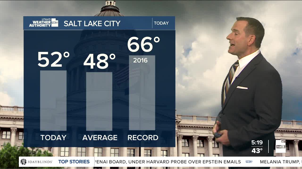
SALT LAKE CITY
Thursday: Mostly cloudy & cooler with a 50 percent chance of rain. Highs: Near 50.
Thursday Night: Mostly cloudy with a 30-40% chance of rain. Lows: Near 40.
ST. GEORGE
Thursday: Partly sunny. Highs: Mid 50s.
Thursday Night: Becoming mostly cloudy. Lows: Lower 40s.
