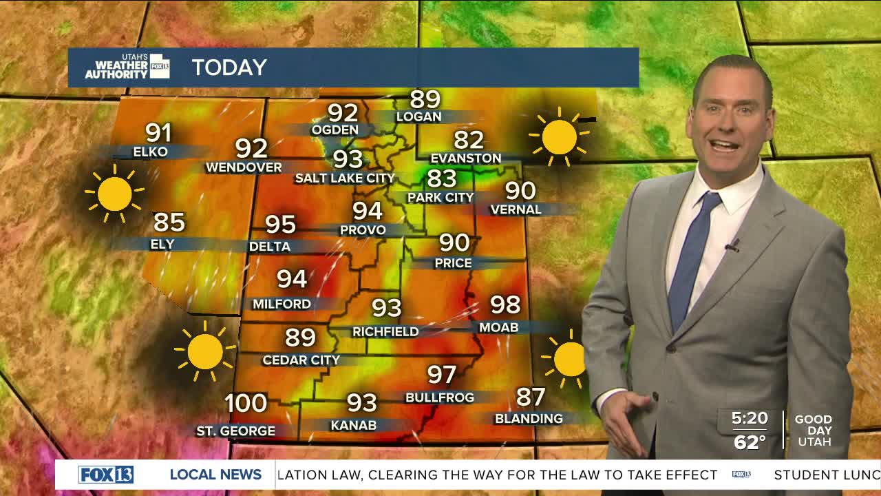


May is feeling like July with near record heat through tomorrow! Take frequent breaks and drink plenty of water!
Dry, windy conditions will develop tomorrow and lead to increasing fire danger across SW UT.
Isolated to widely scattered dry thunderstorms could impact much of the state Wednesday afternoon and evening, with gusty winds possible near any thunderstorms.
A cold front moves in late Wednesday with much cooler temps by Thursday.
SALT LAKE CITY
Tuesday: Sunny & warmer. Highs: Low 90s.
Tuesday Night: Mostly clear. Lows: Mid 60s.
ST. GEORGE
Tuesday: Sunny. Highs: Near 100.
Tuesday Night: Partly cloudy in the evening then becoming mostly cloudy overnight. Lows: Upper 60s.
